Chimanimani National Park
| Chimanimani National Park | ||
|---|---|---|
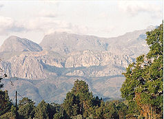
| View from Chimanimani to part of the national park | ||
|
|
||
| Location: | Zimbabwe | |
| Next city: | Mutare | |
| Surface: | unknown km² | |
| Founding: | 1950 | |
The Chimanimani National Park is a national park in Zimbabwe , which has been designated the 1950s.
It is located in the eastern highlands of Zimbabwe, near the city of Mutare . It is a mountain park that can only be hiked on foot. Typical safari animals do not live here, but the landscape is very varied. There are no overnight accommodations in the national park, apart from a very simple refuge without running water and electricity in the north of the national park. In the whole area, however, there are simple small caves in which it is good to stay overnight, small mountain streams supply the hiker with fresh water. The borders to Mozambique in the national park have been open for some years , so it is now a cross-border park.
The highest point in the Chimanimani Mountains is Monte Binga at 2,436 meters. The summit is just over the border in Mozambique.
In earlier times, the Skeleton Pass , located in the national park, was a route used by slave traders.
Tourist camps have been set up on the Mozambican side in recent years.
As part of the establishment of Peace Parks in Africa, this park is to extend over both countries. The two states of Mozambique and Zimbabwe have already drawn up and signed a declaration of intent on this. The new Peace Park will be called Chimanimani Transfrontier Conservation Area .
Web links
- Zimbabwe Parks & Wildlife Management Authority: Chimanimani National Park Overview and Attractions . on www.zimparks.org (English)
- World Database on Protected Areas - Chimanimani National Park (English) Chimanimani in Zimbabwe

