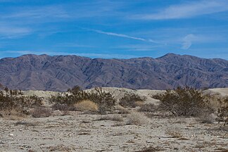
Chocolate Mountains
| Chocolate Mountains | ||
|---|---|---|
| location | California (USA) | |
|
|
||
| Coordinates | 33 ° 28 ′ N , 115 ° 35 ′ W | |
The Chocolate Mountains ( German "Schokoladenberge" ) are a mountain range in Imperial County and in Riverside County in the Colorado desert in southern California . The mountain range extends for around 100 km in a north-west-south-east direction. It separates the Salton Depression from the Coachella Valley and Imperial Valley in the west from the valley of the Colorado River in the east.
The highest point of the mountains reaches 877 m , but the mountains appear higher because the Salton Depression at its foot in the Salton Sea extends to about 72 meters below sea level. In the southwest, under the mountain range, lie the Algodones dunes , whose sand dunes in the eastern part are transported directly under the mountains by the wind.
In the mountains is the Chocolate Mountains Gunnery Range , where the US Navy and US Marines regularly conduct target practice. This military training area has an area of approximately 157,000 hectares and thus takes up most of the mountain range.

