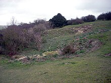
Cissbury
Cissbury is an Iron Age fortification with bell- beaker burial mounds and a complex of Neolithic flint mines at Findon north of Worthing in West Sussex , England.
Ring wall
Cissbury Hill, an arm of the South Downs , is 184 m high. At its summit is the Cissbury Ring (also called Cissbury Camp ) Hillfort . The double fastening ring from the late Iron Age is interrupted by two pincer gates. There are also two modern breakthroughs; the larger of these was created in the Second World War to bring a gun into position. The inner area has not been adequately investigated, but was probably not completely built up. The complex was built from 300 BC. Used until about the turn of the century. Some researchers suspect a central tribal seat here. Presumably medieval arable terraces prove the later use of the inner area. Under Elizabeth I there was a lookout and signal beacon (Armada beacon) here, which was supposed to warn of the arrival of the Spanish fleet.
Research history
The first excavation of the flint mines took place in 1867 by Canon Greenwell and General Pitt Rivers , then still Augustus Lane-Fox. They seem to have limited themselves to the investigation of the bell-jar-era burial mounds. In 1873 Ernest Willett dug one of the flint mines, but did not reach the bottom of the shaft. In 1875, Pitt-Rivers explored nine other shafts and uncovered an early Neolithic shell from the Windmill Hill culture and a human skeleton.
However, it was only the postman John Pull (1899–1960) who, after excavations in Blackpatch and Church Hill, also clarified the structure of the Neolithic shafts in Cissbury. Excavations with a team of volunteers took place from 1952 to 1956. Four shafts and numerous pitches were uncovered. In Cissbury, axes were mainly made. The finds from Cissbury are in the British Museum and the Worthing Museum.
Flint mines
The spoil heaps of the flint mines are in the southern third of the fortification and on the slope below the ramparts. The shafts were 2–3 meters in diameter and 4–5.5 m deep. Numerous lateral galleries branched off at the bottom of the shafts. They were dug with antlers , the traces of which can be found in the walls of the corridors. They were filled with overburden after the pending flint had been removed. The finds consisted mainly of antlers, ax blanks and litter. Shaft 27 contained the skeleton of a 20 year old woman. It does not seem to be the victim of a mine accident, as originally assumed, but a regular burial.
Dating
The bowls with sharp edges, fuller necks and round bases belong to the early Neolithic Windmill-Hill culture. This chronological assignment is supported by three radiocarbon dates.
| Laboratory number | Date BP | BC cal (1 sigma) | Sample material |
|---|---|---|---|
| BM-183 | 4720 ± 150 | 3950-3000 | Antler pick dig pull |
| BM-184 | 4650 ± 150 | 3800-2999 | Antler pick dig pull |
| BM-185 | 4730 ± 150 | 3950-3000 | Antler tip |
This means that Cissbury joins the Sussex flint mines, which were established at the beginning of the Neolithic.
literature
- E. Cecil Curwen, RP Ross Williamson: The date of Cissbury Camp. In: Antiquaries Journal. Vol. 11, No. 1, 1931, 14-38, doi : 10.1017 / S0003581500033205 .
- Augustus Lane-Fox : Excavations at Cissbury Camp, Sussex; being a Report of the Exploration Committee of the Anthropological Institute for the Year 1875. In: Journal of the Anthropological Institute. Vol. 5, 1876, pp. 357-390, doi : 10.2307 / 2840899 .
- Miles Russell: Rough quarries, rocks and hills. John Pull and the Neolithic flint mines of Sussex (= Bournemouth University School of Conservation Sciences Occasional Paper. 6). Oxbow Books, Oxford 2001, ISBN 1-8421-7054-6 .
- Ernest Henry Willett: On flint workings at Cissbury, Sussex. In: Archaeologia. Vol. 45, No. 2, 1880, pp. 337-348, doi : 10.1017 / S0261340900007062 .
Web links
Coordinates: 50 ° 51 ′ 38 " N , 0 ° 22 ′ 58" W.

