South Downs
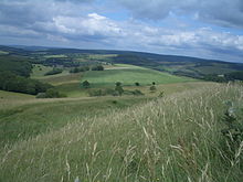
The South Downs (from Old English dun , hill) are a hilly chalk landscape in the south of England, in the counties of East Sussex , West Sussex and Hampshire , which is part of the southern English chalk formation .
The South Downs run parallel to the North Downs , from which they are separated by the Weald . The South Downs are approximately 100 km long. The highest point is Butser Hill south of Petersfield with 270 m. They are drained by Cuckmere , Adur , Ouse , Lavant and Arun .
They are accessible to walkers through the South Downs Way , Monarch's Way and the Sussex Border Path .
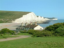
The coasts are sometimes spectacular, the cliffs of Beachy Head (162 m high) and the cliffs of the Seven Sisters between Eastbourne and Seaford are known .
geology
The South Downs are one of only two areas in the south of England where heights of chalk emerge openly over flat terrain. The South Downs run parallel to the North Downs and, together with them, may once have been part of a large dome-shaped elevation made of chalk. Due to erosion , however, the chalk between the two current mountain ranges disappeared, so that a landscape called Weald has now formed, which is characterized by forest-covered depressions between the higher chalk hills.
The soils are fertile rendzinen and a shallow terra fusca , on which wine is now partially grown. In the valleys there are deep colluvia , the origin of which can be traced back to the Bronze and Iron Ages, as studies by Martin Bell show.
economy
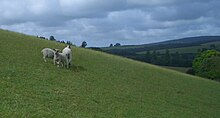
The South Downs are mainly characterized by sheep farming. In the meantime, wine is also grown in places. The leisure industry is becoming increasingly important. England's youngest national park, the South Downs National Park, was opened here on April 1, 2011. Parks such as Queen Elizabeth Country Park, Goodwood Country Park and Petworth Park (deer enclosure) and Arundel Park are primarily used for recreational purposes. Isolated oil deposits, like the one at Singleton , are economically insignificant.
colonization
- Amberley
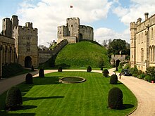
- Arundel with cathedral and castle
- Brighton , seaside resort
- Chichester with cathedral and harbor
- Eastbourne
- ford
- Horndean
- Hove
- Lewes
- Midhurst
- Petersfield
- Port drawer
- Shoreham-by-Sea
Thanks to a good rail connection to London ( Southern to London- Victoria Station ), a number of affluent commuters have now settled in the South Downs.
history
Settlement of the South Downs goes back well into the Paleolithic , as the excavations in Boxgrove show. Silex mines such as Blackpatch and Cissbury and causewayed camps such as the one on the Trundle point to a Neolithic use . Burial mounds from the Bell Beaker Period and the Wessex culture are common. Field terraces like in Bullock Down are evidence of late Bronze Age use. The best known settlement is Black Patch , excavated in the 1970s by Peter Drewett of the Institute of Archeology London . The numerous castle walls can mostly be dated to the early Iron Age . Examples are Bow Hill and the Trundle near Chichester and Cissbury near Worthing and Beacon Hill (South Harting) near South Harting . According to coin finds, the area was inhabited by the Atrebates tribe. In Roman times, Noviomagus was the center of this landscape. The Stane Street is a well-preserved Roman road. Roman villas such as Chilton , Bignor and Batten Hanger were excavated as early as the early 19th century. A chronological assignment of the Long Man of Wilmington , known since around 1710 , has not yet been made, but traces of a Roman settlement have been discovered in its vicinity.
National park
Large parts of the South Downs were assigned to the Areas of Outstanding Natural Beauty in England .
It was suggested from various quarters to set up a national park called South Downs National Park in the area of the South Downs . This movement received public support from the government in 1999 and the national park was officially opened on April 1, 2011.
Museums
The Weald and Downland Museum in West Dean documents the folklore of the Downs with numerous relocated buildings. The museum in Chichester exhibits impressive prehistoric finds, while the Roman palace of King Cogidubnus in Fishbourne (the setting of a novel by Lindsay Davis ) with its spectacular mosaics offers a good insight into the early Roman times. Butser Hill's open-air archaeological museum shows replicas of Iron Age round houses and a Roman villa .
Individual evidence
- ↑ Historic day for South Downs National Park on BBC News April 1, 2011, accessed February 28, 2013
literature
- Martin Bell / John Boardman, Past and present soil erosion: archaeological and geographical perspectives. Oxford: Oxbow Books, 1992. Oxbow monograph 22.
- Peter Drewett, Later Bronze Age Downland economy and excavations at Black Patch, East Sussex. PPS 48, 1982, 321-400.
- Peter Drewett, The archeology of Bullock Down, Eastbourne, East Sussex: the development of a landscape. Lewes, Sussex Archaeological Society, 1982. Sussex Archaeological Society monograph 1.
- M. Russell, Problems of phasing: a reconsideration of the Black Patch middle Bronze Age "nucleated" village. Oxford Journal Archeology 15/1, 1996, 33-38.
Web links
- South Downs National Park (official website)
- South Downs Virtual Information Center
- South Downs Information website
Coordinates: 50 ° 55 ′ 0 ″ N , 0 ° 30 ′ 0 ″ W.


