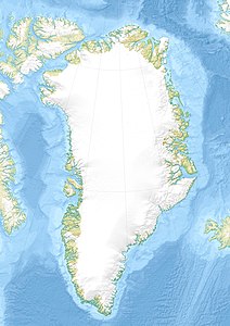
Clavering Ø
| Clavering Ø | ||
|---|---|---|
| Waters | Greenland Sea | |
| Geographical location | 74 ° 16 ′ N , 21 ° 8 ′ W | |
|
|
||
| length | 58 km | |
| width | 40 km | |
| surface | 1 535 km² | |
| Highest elevation | Ortlerspids 1604 m |
|
| Residents | uninhabited | |
| main place | Eskimonæs (historical) | |
| Card with clavering Ø (1932) | ||
Clavering Ø ( German "Clavering Island" ) is a large, now uninhabited island off the east coast of Greenland . Administratively it belonged to the province of Tunu ("East Greenland") until the end of 2008 , as well as to the non-parish area of the Northeast Greenland National Park .
geography
The island is located in the Greenland Sea , just two kilometers south of the Wollaston Forland peninsula . It is separated from this by the Young Sund and the Tyrolerfjord, from Payerland in the west by the Rudibucht and the Copelandfjord. Clavering Ø is about 58 km long, up to 40 km wide and has an area of 1535 km², which makes it the seventh largest island in Greenland. Its highest point is given as 1604 meters above sea level.
history
The island was named after Douglas Charles Clavering , a British polar explorer who had explored this region in 1823 , by the Second German North Polar Expedition 1869-1870 under Carl Koldewey . Clavering came across a group of twelve Inuit here in August 1823, whose behavior and appearance he briefly described. His expedition was the first and last encounter between Europeans and this ethnic group. The Koldewey expedition found only half-dilapidated, uninhabited huts and other remains of the Northeast Greenlanders on Clavering Island , which were probably extinct around 1850.
In 1931, the polar explorer Lauge Koch built the Eskimonæs research station near the southern tip of the island , named after the earlier Inuit settlement Eskimonæsset, which was discovered here in March 1907 . The station served as a wintering station for researchers from 1931 to 1939 and during World War II from 1941 to 1943 as the headquarters of the Nordøstgrønlands Slædepatrulje , forerunner of the Sirius patrol . The American code name of the station was until it was destroyed on March 25, 1943 by the German company Holzauge Bluie East 5 . The code name was then used for the former Norwegian station Myggbukta , 67 kilometers further south .
See also
Web links
Individual evidence
- ↑ Gazetteer of Greenland - Islands ( Memento of the original from June 15, 2011 in the Internet Archive ) Info: The archive link was inserted automatically and has not yet been checked. Please check the original and archive link according to the instructions and then remove this notice. (English)
- ↑ Clavering Island High Point on Peakbagger.com (English)


