Colunas
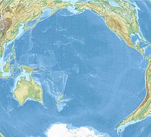
approximate position of the Dos Colunas Islands |
The Dos Colunas , also called Las Colunas , are, according to the Swedish scholar Erik Wilhelm Dahlgren, probably the two southernmost islets of today's Japanese Izu Islands , namely Torishima (also called Ponafidin ) and Sōfugan ( Lot's Wife ).
Dos Colunas appear for the first time in 1594 under about 25 ° N on a map by the Dutch cartographer Petrus Plancius . Richard Hakluyt (Wright-Hakluyt Map) raises them to a latitude of 28 ° to 30 ° N, while later Spanish nautical charts in the sea area between 28 ° 30 'and 32 ° 30' N and 153 ° and 157 ° E, i.e. set considerably too far to the east.
If one assumes that the earliest sources are the more authentic, the latitude of 25 ° N would indicate the Kazan-rettō (volcanic islands) to the south . Kita-Iwojima and Minami-Iwojima , the northernmost and southernmost of the volcanic islands, are both conical and 802 and 970 meters high, respectively, while the present-day relatively flat profile of the central island of Iwojima (highest elevation 166 meters) is due to a volcanic eruption in the past can go back. The term “coluna” (Spanish for column ) fits best on Sōfugan , but a clear assignment is not possible due to the vague, often contradicting position information . At the time in question, even halfway correct length determination at sea could not be solved ( length problem ).
Individual evidence
- ^ Dahlgren, Erik Wilhelm: Were the Hawaiian Islands visited by the Spaniards before their discovery by Captain Cook in 1778? In: Kungliga Svenska Vetenskapsakademiens handlingar, Ny Följd, Vol. 57, No. 4; Stockholm 1916, p. 100 f.
- ↑ Petrus Plancius: Orbis terrarum typus de integro multis in locis emendatus , 1594 ( color scan )
- ^ A Chart of the World on Mercator's Projection . In: The Principal Navigations by Richard Hakluyt, 1599 ( color scan )
- ↑ Dahlgren 1916, p. 160 and 163
- ↑ Dahlgren 1916, pp. 108, 115 and 119
- ↑ Japan pilot, Vol. 2; 1964 (6th ed.), P. 513 and P. 560, view no. 50 and p. 511 u. P. 599, view no. 48 resp.
Coordinates: 30 ° 0 ′ 0 ″ N , 155 ° 0 ′ 0 ″ E
