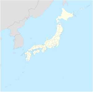
Torishima (Izu Islands)
| Torishima | ||
|---|---|---|
| Aerial view of Torishima | ||
| Waters | Pacific Ocean | |
| Archipelago | Izu Islands | |
| Geographical location | 30 ° 29 '4 " N , 140 ° 18' 4" O | |
|
|
||
| length | 2.7 km | |
| width | 2.7 km | |
| surface | 4.78 km² | |
| Highest elevation | Iō-zan 394 m |
|
| Residents | uninhabited | |
| main place | Tamakisato (historical) | |
| Torishima seen from the sea | ||
Torishima ( Japanese 鳥島 , literally: Bird Island , formerly Ponafidin Island ) is a small island of volcanic origin in the Pacific Ocean . It is the second southernmost island in the Izu Islands . To distinguish it from other Japanese " bird islands ", it is sometimes referred to as Izu-Torishima .
administration
Like the entire chain of Izu Islands, Torishima belongs administratively to Tokyo Prefecture . They are part of the Hachijō sub-prefecture, which is administered from Hachijō-jima . However, like the three Izu Islands Bayonnaise Rocks , Sumisu-jima and Sōfugan, they do not belong to any municipality and are therefore de facto an area free of municipalities . However, they are claimed by the communities of Aogashima and Hachijō .
geography
Torishima is located about 575 km south of Tokyo and 76 km north of the rocky island of Sofugan . The almost round island has a diameter of 2.7 km and an area of 4.79 km² and reaches a height of 394 m with the Iō-zan (outdated also Iwo-zan; 硫 黄山 , German "sulfur mountain ") the sea. Torishima represents the summit of a stratovolcano that has had numerous eruptions in recent times , most recently in 2002. The current appearance of the island with its vegetation-free cone is the result of an eruption in 1939. Torishima was inhabited (main town: Tamakisato) until all 125 inhabitants died in an eruption in August 1902. By the ejection of ash and phreatomagmatic explosions all the houses were destroyed; there were also submarine eruptions in the vicinity of the island. A later established meteorological station was abandoned in November 1965 after a series of earthquakes ; its ruins are still present at Hatsune Cape ( 初 寝 崎 , Hatsune-zaki ) in the west of the island.
The island is an important breeding area for seabirds , especially the short-tailed albatross ( Phoebastria albatrus ) and the black-footed albatross ( Phoebastria nigripes ), and part of the Fuji-Hakone-Izu National Park . Torishima is a bird sanctuary and may only be entered with permission and only for scientific purposes.
Web links
- Torishima in the Global Volcanism Program of the Smithsonian Institution (English)
- Izu Torishima in the Japanese Volcanoes Quaternary database (English and Japanese)
- Article with pictures of the 2002 eruption ( memento from March 5, 2009 in the Internet Archive )
Individual evidence
- ↑ 東京 都 . (PDF; 65.9 kB) (No longer available online.) In: 平 成 27 年 全国 都 道 府 県 市区 町 村 別 面積 調 . Kokudo Chiri-in , October 1, 2015, archived from the original on July 29, 2016 ; Retrieved July 30, 2016 (Japanese). Info: The archive link was inserted automatically and has not yet been checked. Please check the original and archive link according to the instructions and then remove this notice.
- ↑ 島 面積 . (PDF; 136 kB) (No longer available online.) Kokudo Chiriin , October 1, 2015, archived from the original on June 15, 2016 ; Retrieved July 30, 2016 (Japanese). Info: The archive link was inserted automatically and has not yet been checked. Please check the original and archive link according to the instructions and then remove this notice.
- ↑ Torishima in the Japanese Volcanoes Quaternary database ; Inhabitants of island all killed by vulcano In: The New York Times , August 19, 1902 (PDF, 18 kB, accessed December 14, 2012).
- ↑ Torishima in the Japanese Volcanoes Quaternary database (accessed July 30, 2016)


