
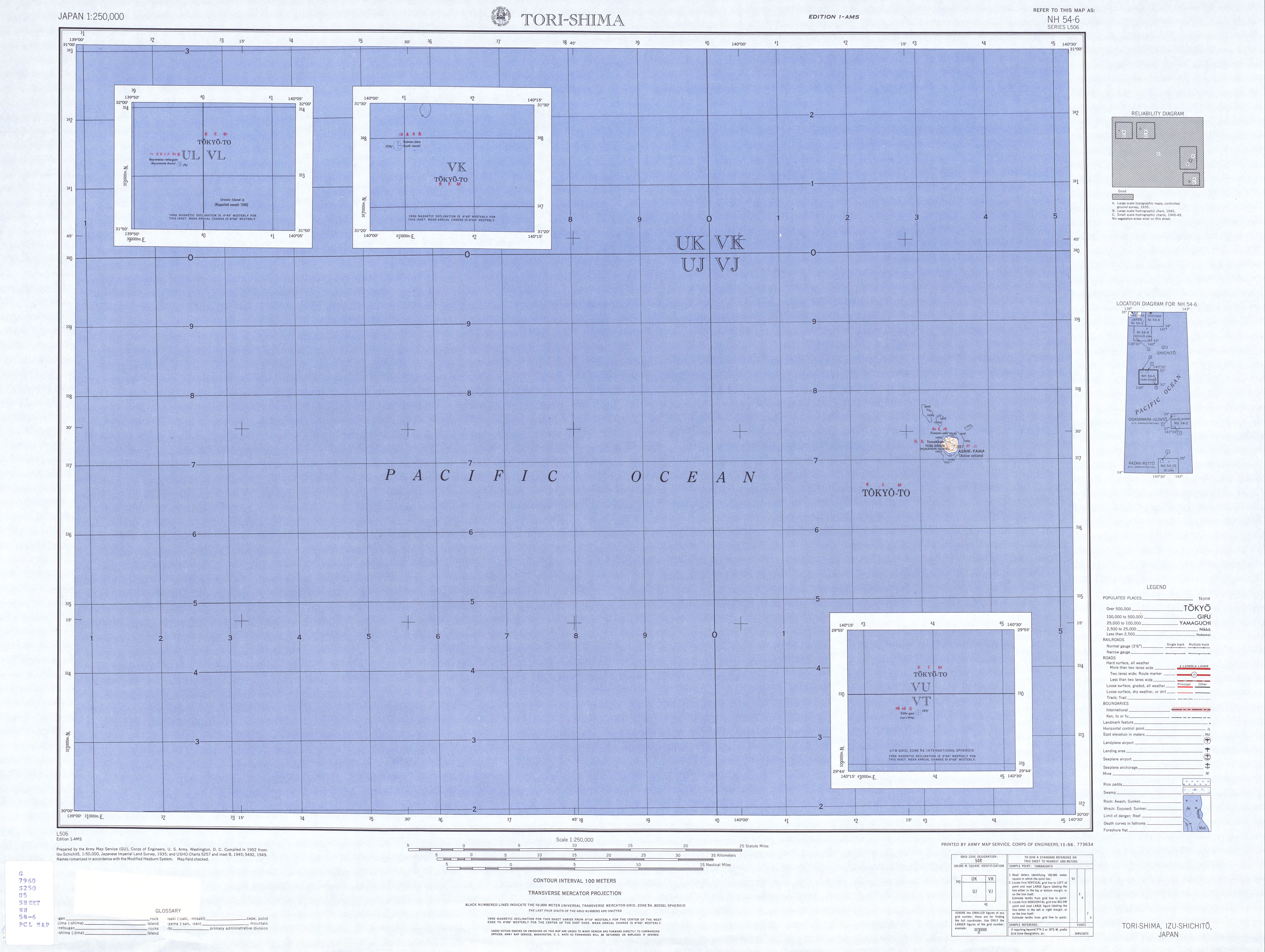
Bayonnaise Rocks
| Bayonnaise Rocks Bayonnaise retsugan |
||
|---|---|---|
 |
||
| Waters | Pacific Ocean | |
| Archipelago | Izu Islands | |
| Geographical location | 31 ° 53 '14 " N , 139 ° 55' 3" E | |
|
||
| surface | 1 ha | |
| Highest elevation | 11 m | |
| Residents | uninhabited | |
 |
||

The Bayonnaise Rocks ( Japanese ベ ヨ ネ ー ス 列 岩 , Beyonēsu-retsugan , eng . "Bayonnaise rock chain ") are a small, uninhabited group of rock islands of volcanic origin in the Pacific Ocean . They lie between Aogashima and Sumisu-jima of the Japanese Izu Islands .
administration
Like the entire chain of Izu Islands, the Bayonnaise Rocks are administratively part of Tokyo Prefecture . They are part of the Hachijō sub-prefecture, which is administered from Hachijō-jima . However, like the three Izu Islands further south ( Sumisu-jima , Torishima and Sōfugan ), they do not belong to any municipality and are therefore de facto an area free of municipalities . They are claimed by the communities of Aogashima (based on the closest island of Aogashima, 64 km away) and the community of Hachijō , 130 km further north .
geography
The Bayonnaise Rocks are 408 km south of Tokyo and 65 km south-southeast of the neighboring island of Aogashima . The southern neighboring uninhabited island of Sumisu-jima is 49 km away, making it the closest country. Volcanic activity has been known in the region since 1869, and there have been several eruptions since then. The last volcanic eruption was in 1970. The rocks lie on the western edge of a submarine caldera , which only rises above the water level there. Eight kilometers further east is the reef Myōjin-shō ( 明 神 礁 ), a post-caldera cone with a minimum depth of 50 meters.
During the volcanic eruption of September 17, 1952, an island consisting of a lava dome with a height of several tens of meters was briefly formed at the site of the reef Myōjin-shō , which was destroyed several times in subsequent eruptions and rebuilt until it was last on 3. September 1953 sank again. The Japanese research ship Kaiyo-Maru sank in an eruption on September 24, 1952 ; all 31 people on board died. Currently the shallowest water depth there is 50 meters.
The vegetation of the Bayonnaise Rocks is sparse. The islands are a resting place for migratory birds.
The rocky islands were named after the French warship Bayonnaise , with which they were discovered in 1846.
Urania Island
Urania Island was a short-lived island at 31 ° 56 ′ N , 140 ° 0 ′ E about 10 km northeast of Bayonnaise Rocks. The volcanic island emerged from the sea in February 1946, grew to a height of 46 m by March and then sank again in the sea by January 1947. The island was named after the destroyer HMS Urania, who discovered it at the time of its creation.
swell
- ↑ 東京 都 . (PDF; 65.9 kB) (No longer available online.) In: 平 成 27 年 全国 都 道 府 県 市区 町 村 別 面積 調 . Kokudo Chiri-in , October 1, 2015, archived from the original on July 29, 2016 ; Retrieved August 3, 2016 (Japanese). Info: The archive link was inserted automatically and has not yet been checked. Please check the original and archive link according to the instructions and then remove this notice.
- ^ Christopher G. Newhall, Daniel Dzurisin: Historical Unrest at Large Calderas of the World. Volume 1, US Geological Survey Bulletin 1855, Washington 1988, p. 506. See also: Bathymetric map around "Bayonnaise Rocks" based on Basic Map of the Sea ( Memento of December 27, 2012 in the web archive archive.today ) (1: 50,000 , accessed December 13, 2012).
- ^ Wreckage found near sea volcano. In: The Courier-Mail , Brisbane, September 29, 1952, p. 1.
- ↑ Yashima, Survey of Myojin-sho , p. 1 (English, PDF file; 164 kB).
- ↑ The Seewart . Nautical magazine for Deutsche Seeschiffahrt. 1956, p. 25 ( limited preview in Google Book search).
- ↑ United States Hydrographic Office (Ed.): Sailing Directions for Japan . 1951, p. 275 ( limited preview in Google Book Search).
- ↑ Vincent H. Gaddis: Invisible Horizons . Ace Books, 1965, pp. 28 ( limited preview in Google Book search).
Remarks
- ↑ On a map issued by the US Army Map Service in 1953, map sheet NH 54-6 shows the island southeast of Bayonnaise Rocks. However, the Bayonnaise Rocks are here at the coordinates 31 ° 55 'N, 139 ° 54' E and Urania Island at 31 ° 52 'N, 140 ° 0' E.
Web links
- Bayonnaise Rocks in the Global Volcanism Program of the Smithsonian Institution (English)
- Bayonnaise Rocks in the Japanese Volcanoes Quaternary database (English and Japanese)
- Kunio Yashima, Azusa Nishizawa, Yasuo Ootani: The Survey of Myojin-sho, the Submarine Volcano by Unmanned Radio Operating Survey Boat "Manbou II" . (English, PDF file; 164 kB)