Kazan-rettō
| Kazan-rettō | ||
|---|---|---|
|
Satellite image of Kazan rettō, Kita-Iwojima above, Iwojima in the middle, Minami-Iwojima below |
||
| Waters | Pacific Ocean | |
| Geographical location | 24 ° 46 ′ N , 141 ° 18 ′ E | |
|
|
||
| Number of islands | 3 | |
| Main island | Iwojima | |
| Total land area | 30 km² | |
| Residents | 400 | |
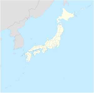
Kazan-rettō ( Japanese. 火山 列島 , dt. "Volcanic island chain"), in English also called Volcano Islands , or Iō-rettō ( 硫黄 列島 , dt. "Sulfur islands "), denotes a small group of islands about 1200 km southeast of the Japanese Main island is Honshu . Administratively, the chain of islands belongs to the municipality ( mura , also village ) Ogasawara and thus to the Japanese prefecture of Tokyo .
geography
The chain of islands is 150 km southwest of Ogasawara-guntō (also "Bonin Islands") and 200 km south of the island of Nishinoshhima , which lies on the same submarine ridge. It consists of three islands that are almost 140 km from north to south:
- Kita-Iwojima ( 北 硫黄島 , Kita-Iōtō , literally: "North Sulfur Island", 25 ° 26 '2 " N , 141 ° 17' 0" E ), 5.57 km², 792 m (Sakaki-ga-mine ).
- Iwojima ( 硫黄島 , Iōtō , literally: "sulfur island", 24 ° 47 ′ N , 141 ° 19 ′ E ), 20.60 km², 166 m (Suribachi-yama).
- Minami-Iwojima ( 南 硫黄島 , Minami-Iōtō , literally: "South Sulfur Island", 24 ° 14 ′ 1 ″ N , 141 ° 27 ′ 45 ″ E ), 3.54 km², 916 m.
In addition, some submarine volcanoes are geographically part of Kazan-rettō.
The currently uninhabited islands have a total area of almost 30 km² and reach a height of 916 m (on Minami-Iwojima ) above the sea. They lie on a volcanically active sea ridge ("Honshū ridge"), which extends from Honshū over the Izu Islands to the Mariana Islands .
The islands currently have no civilian population, but Iwojima is an air force base with 400 soldiers (Iwojima Air Base, IATA code IWO, ICAO code RJAW).
history
The islands were discovered in 1543 by Bernardo de la Torre and therefore claimed by Spain , but without emphasis, as no further exploration or even settlement took place. The islands were officially visited by the Japanese for the first time in 1887 and integrated into the Empire in 1891.
The two islands of Colunas were listed on historical European nautical charts for the first time in 1594 , one theory of which identified them with Kazan-rettō.
The two northern islands of Kita-Iwojima and Iwojima were previously inhabited, but Minami-Iwojima was not. The settlement took place in 1889, before the official integration into the Japanese state association, by farmers from the Izu Islands. Initially cotton was grown, but with little success, and around 1910 they switched to sugar cane . Sugar production peaked during the First World War . The subsequent decline was partially halted by the cultivation of coconut, coffee, indigo and medicinal plants. Fishing never developed into an industry. The population was around 1100 at the beginning of World War II , 103 of them on Kita-Iwojima and the rest on the main island of Iwojima . This civilian population was evacuated during World War II in 1944.
From 1940 the until then unincorporated islands formed the community ( mura ) Iōtō ( 硫黄島 村 ). The local government was based on Iwojima in the district of Higashi ( West ). When the United States returned the islands to Japan in 1968, the islands were incorporated into the newly formed community of Ogasawara .
gallery
Web links
- Kazan rettō (satellite images) on oceandots.com ( Memento from December 23, 2010 in the Internet Archive ) (English)


