Minami-Iwojima
| Minami-Iwojima | ||
|---|---|---|
| Aerial view of Minami-Iwojima | ||
| Waters | Pacific Ocean | |
| Archipelago | Kazan-rettō | |
| Geographical location | 24 ° 14 '5 " N , 141 ° 27' 45" E | |
|
|
||
| length | 2.1 km | |
| width | 1.9 km | |
| surface | 3.54 km² | |
| Highest elevation | 916 m | |
| Residents | uninhabited | |
| map | ||
Minami-Iwojima ( Japanese 南 硫黄島 , Minami-Iōtō , literally: "South sulfur island ") is the southernmost of the islands belonging to the Ogasawara Islands archipelago of the Kazan-rettō ( volcanic islands ), which are located south of the main Japanese islands. Like the entire archipelago, it is administratively part of Tokyo Prefecture . On June 18, 2007, the name was changed from Minami-Iōjima to Minami-Iōtō, in which the Kun reading was changed back from früh to the earlier On reading .
geography
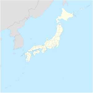
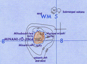
Minami-Iwojima is located 60 km south of Iwojima and a good 1300 km south of Tokyo . The almost round island has an area of 3.54 km² with a coastline of 7.5 km and reaches a height of 916 m above sea level. Minami-Iwojima thus represents the highest island of the entire Ogasawara Archipelago. The next island in the south is Farallon de Pajaros , which is about 540 km away and belongs to the Northern Marianas . The island consists of a stratovolcano that last erupted less than 700,000 years ago.
Minami-Iwojima is one of five Japanese "areas for the preservation of the untouched, natural environment" ( 原 生 自然環境 保全 地域 , gensei shizen kankyō hozen chiiki ). The uninhabited island has been a nature reserve since May 17, 1975 . The first comprehensive scientific inventory of flora and fauna took place in 2017 after the island had been entered by humans for the first time since it was established as a nature reserve 10 years earlier.
Web links
- Wilderness Areas in Japan (English)
- Minami-Iwo in the Japanese Quaternary Volcanoes database (English)
Individual evidence
- ↑ a b Tokyo's Lost Islands: Minami Iwo-to. In: NHK . February 16, 2019, accessed October 21, 2019 .
- ↑ 島 面積 . (PDF; 144 kB) (No longer available online.) Kokudo Chiriin , October 1, 2014, archived from the original on April 2, 2015 ; Retrieved July 28, 2016 (Japanese). Info: The archive link was inserted automatically and has not yet been checked. Please check the original and archive link according to the instructions and then remove this notice.
- ↑ 天然 記念 物 : 自然 ( Eng . "Natural monument: nature"). Ogasawara Village, accessed July 28, 2016 (Japanese).


