Conondale Range
| Conondale Range | ||
|---|---|---|
| Highest peak | Mount Langley ( 868 m ) | |
| part of | Great dividing range | |
|
|
||
| Coordinates | 26 ° 50 ′ S , 152 ° 45 ′ E | |
| particularities | Conondale National Park | |
The Conondale Range is a mountainous country in Queensland , Australia , which lies between Maleny , Kenilworth , Kilcoy and Jimna .
location
The hill country is the westernmost part of the hinterland of the Sunshine Coast region and part of the Great Dividing Range . The highest point in the mountains is Mount Langley , which reaches a height of 868 meters above sea level. This mountain also forms the highest point of the Brisbane River's catchment area .
Flat mountain foothills around Kilcoy that are overgrown with grass are used for agriculture. Most of the steep slopes of the hill country are state forests and are in the Conondale National Park area .
The creeks in the south of the hill country drain into the Stanley River and directly into Lake Somerset . The northern streams flow into the Mary River .
fauna
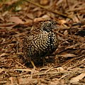
Approximately 1,620 km² of the Conondale Range is classified as BirdLife International and an Important Bird Area because it contains an isolated and northernmost population of the endemic Dasyornis brachypterus that was not discovered until the 1980s. It is also the habitat of a large population of black breast Laufhühnchen ( Turnix melanogaster ), Fahlgesichtschnäpper ( Tregellasia capito ) Shield bird of paradise ( Ptiloris paradiseus ), Regent Bowerbird , Regent Bowerbird ( Sericulus chrysocephalus ), green Laubenvogel ( Ailuroedus crassirostris ) and Orthonyx temminckii .
The southern gastric nesting frog ( Rheobatrachus silus ) and Mixophyes fleayi are two endemic species of frog that live in and near the Conondale Range .
See also
Individual evidence
- ^ Conondale Range Great Walk (pdf) Department of Environmental and Resource Management. May 2010. Archived from the original on March 29, 2011. Info: The archive link was automatically inserted and not yet checked. Please check the original and archive link according to the instructions and then remove this notice. Retrieved April 29, 2011.
- ^ Eastern Bristlebird . Department of Environment and Resource Management. September 3, 2009. Archived from the original on January 5, 2010. Info: The archive link was inserted automatically and has not yet been checked. Please check the original and archive link according to the instructions and then remove this notice. Retrieved December 23, 2009.
- ↑ IBA: Conondale Range . In: Birdata . Birds Australia. Retrieved June 16, 2011.


