Cornelis de Jode
Cornelis de Jode (also: Cornelius de Iudaeis , * 1568 in Antwerp , † October 17, 1600 in Mons ) was a Dutch cartographer , engraver and publisher .
Life
Cornelis de Jode was born in 1568 as the son of the respected Antwerp printer and cartographer Gerard de Jode (1509–1591). When Cornelis was ten years old, his father published the atlas Speculum Orbis Terrarum (German mirror of the world ). Gerard de Jode's work competed with the Theatrum Orbis Terrarum by Abraham Ortelius , which today is generally considered to be the first atlas in the modern sense. Despite the quality of Gerard de Jode's maps, his work could not assert itself because Ortelius had already occupied the market for atlases.

After the death of his father, Cornelis continued his work on an expanded new edition of the atlas. This was published in 1593 under the title Speculum Orbis Terræ , which was slightly different from its predecessor . For the new edition, Cornelis took over 50 of the 64 maps from his father’s edition from 1578 and added new maps, such as those for China and parts of America. Cornelis de Jodes Speculum Orbis Terræ was just as unsuccessful commercially as his father's predecessor. Van Duzer and Beck attribute this to the fact that Ortelius' Theatrum Orbis Terrarum was already available in Dutch, German, French and Italian in 1793.
When Cornelis de Jode died at the age of 32, the Antwerp publisher Joan Baptista Vrients bought the printing plates for the Speculum Orbis Terræ from de Jode's estate. Due to the fact that Vrients had previously acquired the printing plates from Ortelius' Theatrum Orbis Terrarum and de Jodes Speculum Orbis Terræ did not receive any new editions, it can be assumed that Vrients de Jodes bought printing plates solely in order to face undesirable competition with Ortelius 'Discard Atlas.
Works
- Speculum Orbis Terræ , Antwerp 1593 ( digital copies of some sheets from Stanford University's holdings)
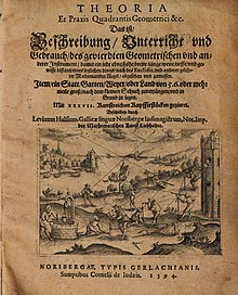
- Theoria Et Praxis Quadrantis Geometrici & c. That is the description, instruction and use of the quadrangular geometry and other instruments […] , Nuremberg 1594 ( digitized full edition of the Austrian National Library)
literature
- Peter van der Coelen (Ed.): The de Jode dynasty , Volume 4: Gerard and Cornelis de Jode, edited by Marjolein Leesberg, Ouderkerk aan den Ijssel [2018], ISBN 978-94-91539-52-7 .
- Fernand Gratien van Ortroy: L'œuvre cartographique de Gérard et de Corneille de Jode , Ghent 1914.
Web links
Remarks
- ↑ Chet A. Van Duzer / Lauren Beck: Canada before Confederation: Maps at the Exhibition , Wilmington, Delaware 2017, p. 104.
- ↑ a b The Benevento Copy. The Earliest Printed Map of the Northwest Coast of North America , Barry Lawrence Ruderman Antique Maps Inc., last accessed June 29, 2019.
- ^ Stanford Libraries, Renaissance Exploration Map Collection, Highlights from the Collection, Speculum orbis terrae , Notes
- ↑ Van Duzer / Beck: Canada before Confederation , p. 105.
| personal data | |
|---|---|
| SURNAME | Jode, Cornelis de |
| ALTERNATIVE NAMES | Iudaeis, Cornelius de |
| BRIEF DESCRIPTION | Dutch cartographer |
| DATE OF BIRTH | 1568 |
| PLACE OF BIRTH | Antwerp |
| DATE OF DEATH | 17th October 1600 |
| Place of death | Mons |
