Cuauhtémoc (Chihuahua)
| Cuauhtémoc | ||
|---|---|---|
|
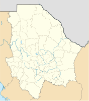
Coordinates: 28 ° 24 ′ N , 106 ° 51 ′ W Cuauhtémoc on the map of Chihuahua
|
||
| Basic data | ||
| Country | Mexico | |
| State | Chihuahua | |
| Municipio | Cuauhtémoc | |
| Residents | 114.007 (2010) | |
| Detailed data | ||
| height | 2063 m | |
| Post Code | 31500 | |
| prefix | 625 | |
| City Presidency | Israel Beltrán Montes | |
Cuauhtémoc is a city of 114,000 people in the Mexican state of Chihuahua . The third largest city in the state is the administrative seat of the Municipio Cuauhtémoc . The city was named after the last Aztec ruler Cuauhtémoc . The place was originally called San Antonio de los Arenales and was little more than a train station. Only after the settlement of Russian Mennonites in the early 1920s did the place first develop into a business center for the Mennonite settlers and later into a city. Today around 50,000 German-speaking Mennonites live in the vicinity of Cuauhtémoc.
Diocese of Cuauhtémoc-Madera
sons and daughters of the town
- Gabino Amparán (* 1968), Mexican football coach
- Cornelio Wall , actor
swell
- Walter Schmiedehaus: A solid castle is our God. GJ Rempel, 1948
- Map of the Mennonite colonies, created by Walter Schmiedehaus

