Curepe
| Curepe | ||
|---|---|---|
|
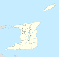
Coordinates: 10 ° 38 ′ N , 61 ° 24 ′ W Curepe on the map of Trinidad and Tobago
|
||
| Basic data | ||
| Country | Trinidad and Tobago | |
| Regional Corporation | Tunapuna-Piarco | |
| Residents | 11,375 (2011) | |
| Detailed data | ||
| City structure | 2 | |
| Time zone | UTC −4 | |
| City Presidency | Anita Seeram (COP) | |
| Eastern Main Road | ||
Curepe is a city in Trinidad and Tobago . It is located in the east-west corridor in the Tunapuna-Piarco region .
location
Curepe is located in the north of the island of Trinidad, in the middle of the East-West Corridor , the metropolitan region of the state capital Port of Spain south of the Northern Range from west to east . Since Port of Spain is bounded in the north by the Northern Range and in the south by the Caroni Swamp , the city expanded to the east over time. The resulting east-west corridor is so densely populated that in the past independent cities merge into one another and now have the character of districts of the capital agglomeration. However, they are still formally independent. Curepe borders Valsayn in the west and is enclosed in a crescent shape by St. Augustine in the east .
structure
The smallest administrative unit in Trinidad is the community , comparable to a German town . Curepe is divided into the communities Curepe and Spring Village.
| Community | Residents |
|---|---|
| Curepe | 8740 |
| Spring Village | 2635 |
| total | 11,375 |
Economy and Transport
One economic factor is the University of the West Indies , whose neighboring campus in St. Augustine has a significant impact on the housing market and retail trade. A lot of business has settled along the west-east routes, but there are no nationally known employers. The TnT Mirror newspaper, which appears twice a week , is based in Curepe.
The Southern Main Road begins in Curepe and was the main artery for traffic between the East-West Corridor and San Fernando before the Uriah Butler Highway was built. Even now, the road is still used frequently, as it connects cities such as Caroni, Couva and Point Lisas and is a bypass of the frequent traffic jams on the Uriah Butler Highway. Curepe also runs along the Eastern Main Road and the Churchill Roosevelt Highway, the country's two main east-west axes.
Facilities
Public facilities in Curepe include a. the Holy Savior Anglican Primary School, the Spring Village Hindu School, the Curepe Presbyterian Church and the Our Lady of Fatima Roman Catholic Church, built in 1962, which attracts believers from afar.
The Curepe Scherzando Steel Orchestra , a nationwide steel band , is based in Curepe. Also in Curepe is the national headquarters of the Trinidad and Tobago Unified Teachers Association .
Personalities
- Nicholas "Trinidad James" Williams (* 1987), rapper and producer
The documentary Queens of Curepe by the Trinidadian filmmaker Michael Mooledhar was shot in Curepe.
Individual evidence
- ↑ Census 2011
- ↑ Fatima at fifty - A historical review . In: Catholic News , Port of Spain, No. 6584, October 7, 2018, p. 12.
- ↑ Newsday of September 22, 2008, available online

