
Cybertracker
Cybertracker is software for PDAs , smartphones and tablet computers to collect any information in the field and later to conveniently evaluate and exchange it.
The term "Cyber Tracker" is a word composed of "cyber" (Greek, a term from the computer world and cybernetics) and "Tracker" (Engl., Trackers ).
The name Cybertracker came about through a project in South Africa that made traditional San hunters' knowledge accessible to the modern world in tracking. The inventor and mentor of this combination of traditional knowledge and high-tech is Louis Liebenberg , South African tracker and specialist in the threatened culture of the San.
There are now numerous applications worldwide.
history
Louis Liebenberg from South Africa was already fascinated by tracing as a physics student. He later became an expert in tracking himself through contact with the San of the Kalahari .
According to Liebenberg, from an evolutionary perspective, reading traces is probably the beginning of scientific thought. From objective facts, such as footprints in the sand and how they change z. B. by wind and weather, conclusions can be drawn with appropriate experience, such as B. Type and age of the animals and the time when the tracks were created. Thus perception becomes speculation or theory through experience . When reading traces, you need the same skills that you need for science today: setting up hypotheses and reasoning. It was only through the evolution of track reading that humans had acquired the ability to do physics and mathematics. Reading tracks is the origin of all science.
Liebenberg's vision was to combine the ancient San tracking art with modern computer technology. That was the birth of the Cybertracker.
Possible uses
The Cybertracker is generally usable for
- the collection of all relevant environmental data (if necessary with precise GPS information)
- wildlife and grazing animal management
- the training of trackers, wildlife biologists, rangers and the like a.
- introducing children to botany and zoology in natural environments ( environmental education )
This results in a possible use z. B. in
- Forestry ( forest damage , species distribution of plants and animals ...)
- Water management ( quality analysis , location determinations for sources, monitoring of technical systems ...)
- Environmental technology (monitoring of decentralized wind turbines ...)
functionality
The software is installed on a Windows PC. It contains an editor for the Cybertracker application. This application contains all queries and input options for the specific application and can be generated by the user independently. Furthermore, the PC software supports the transport of the application to the Pocket PC, the re-import of the data collected by the Pocket PC, their display and evaluation. Extensive filter options and export interfaces are used for this purpose. B. to be able to exchange all the desired data in an Excel table with other interested parties.
Exemplary applications
A complete list of applications can be found on the homepage:
- Greenland: Environmental Monitoring Program in the Arctic
- Ukraine: Mapping of karst and cave properties, (Ukrainian Institute of Speleology and Karstology)
- Antarctica: Marine Biology - Whale Monitoring
- South Africa: University of Stellenbosch , Department of Forest Science
- Malaysia: Monitoring the wild Sumatran rhinos in Tabin . ( Universiti Malaysia Sabah )
- Costa Rica: Tracking Jaguars in the Osa Rainforest.
- UNITED STATES:
- Butterfly censuses in Florida
- Snow leopard reserve monitoring in Sonoma , CA in preparation for f. Snow leopard research in Nepal, India and Pakistan.
- Dolphin research in Southern California.
- Canada: Winnipeg , River Water Quality Monitoring.
Current usage in Germany
In Germany there are some projects under development, such as B.
- Bird mapping (bird classification according to bird order or German alphabet, population, activities, weather, optional map tool for required area)
- Weather analysis (extensive recording of the weather observations. The observation point is provided with GPS coordinates.)
- Track and waypoint recording (Today a fundamental part of all GPS devices. With an adjustable time grid, GPS coordinates of the covered path are automatically recorded. In addition, waypoints with symbols and notes and additional GPS coordinates can be saved.)
- Trace analysis (analysis of animal traces with measurements for footprints, gaits, feces / urine / excretions, signs / activities / cracks, age determination of the traces, classification of animals, weather, soil conditions, optional map tool for required area)
- Large carnivore monitoring (recording of data for bear, wolf and lynx management in Germany)
- Bio-mapping (inventory of plants and animals to collect data to determine biodiversity)
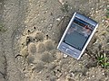
CyberTracker during wolf monitoring

CyberTracker in the training of trackers

References
Web links
- www.cybertracker.org (English)
- www.cybertracker.de , Cybertracker usage, help, application examples (German)
- cybertrackerwiki.org , current software, tips and tricks, examples, documentation, wish list
Press articles
- Film by Louis Liebenberg: "Tracking in the Cyberage"
- Cybertracker in Germany