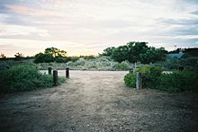
Dalhousie Springs
Dalhousie Springs , also known as Witjiara-Dalhousie Springs , is an area in Witjira National Park in the west of the Simpson Desert , which is home to 70 artesian springs . It is located in northern South Australia , 284 kilometers from Oodnadatta and 540 kilometers from Marla .
It is the largest of the 13 major headwaters of the Great Artesian Basin in Australia. This basin is the largest reservoir of drinking water on earth, formed 250 to 100 million years ago and encompassing a quarter of the Australian continent.
The mineral-enriched water of Dalhousie Springs, which is pressed out there, has a temperature of 38 to 43 ° C; it is drinkable. At the beginning of the 20th century, the volume of water was still greater, in 1989 the springs released 19,300 megaliters of water per year. The water in the Great Artesian Basin moves very slowly, about five meters per year. Therefore, the water from these springs could be around a million years old.
Endemic fish like a coral catfish ( Neosilurus gloveri ), a hard-headed ( Craterocephalus dalhousiensis ) and a desert goby ( Chlamydogobius gloveri ) swim in the water basins around the springs .
The headwaters have been on the Australian National Heritage List since 2009 .
Since Dalhousie Springs has a campsite with a ranger and swimming facilities, this place is also the starting point for the Simpson Desert to Birdsville in Queensland .
Web links
- Desert Springs of the Australian Great Artesian Basin (English; PDF file; 111 kB)
- Information for travelers (English)
Individual evidence
- ↑ Archive link ( Memento of the original dated November 2, 2006 in the Internet Archive ) Info: The archive link was automatically inserted and not yet checked. Please check the original and archive link according to the instructions and then remove this notice. P. 3
- ↑ environment.gov.au : Witjira-Dalhousie Springs, South Australia, more information , in English, accessed September 27, 2011
Coordinates: 26 ° 27 ′ 19.8 ″ S , 135 ° 28 ′ 56.9 ″ E
