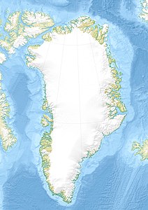
Danmark Ø
| Danmark Ø Ujuaakajiip Nunaa |
||
|---|---|---|
| Milneland satellite image . The non-glaciated island south of it is Danmark Ø. | ||
| Waters | Scoresbysund , Greenland Sea | |
| Geographical location | 70 ° 30 ′ N , 26 ° 15 ′ W | |
|
|
||
| length | 13.3 km | |
| width | 12.4 km | |
| surface | 81 km² | |
| Highest elevation | 380 m | |
| Residents | uninhabited | |
Danmark Ø ( Greenlandic Ujuaakajiip Nunaa ) is an uninhabited island in the inner part of Scoresbysund (Kangertittivaq) on the east coast of Greenland . Administratively, it belongs to the Ittoqqortoormiit district of the Kommuneqarfik Sermersooq municipality .
geography
The island lies at the entrance of the Fønfjord (Ujuaakajiip Kangertiva) south of Milneland (Ilimananngip Nunaa), from which it is separated by the narrow Rensund . It is 13.3 km long in north-south direction and up to 12.4 km wide in east-west direction. Danmark Ø is up to 380 m high in the west and north-west . From here the land slopes down to the southeast, where heights of up to 60 m are only reached. In the south of the island is the natural harbor Hekla Havn , where the East Greenland expedition led by Carl Ryder with the schooner Hekla from August 23, 1891 to August 8, 1892 had its starting point for exploring the extensive fjord system of the Scoresbysund. The geographical name Danmark Ø goes back to Ryder. The expedition found the remains of winter houses as well as graves and numerous artefacts on the island , which show that the coast of Scoresbysund had been inhabited by Inuit relatively recently .
Web links
- Danmark Ø . In: Anthony K. Higgins: Exploration history and place names of northern East Greenland. (= Geological Survey of Denmark and Greenland Bulletin Vol. 21, 2010). Copenhagen 2010, ISBN 978-87-7871-292-9 (English)
Individual evidence
- ↑ Danmark Ø (Hekla Havn) on spitzbergen.de, accessed on February 19, 2017.
- ^ Greenland Pilot. Sailing Directions for East Greenland (PDF; 51.23 MB). Danish Geodata Agency, 1st edition 2015, p. 113. ISBN 978-87-92107-61-9
- ↑ Spencer Apollonio: Lands that Hold One Spellbound . University of Calgary Press, 2008, ISBN 978-1-55238-240-0 , pp. 78 (English, limited preview in Google Book search).

