Milneland
| Milneland | ||
|---|---|---|
| Milneland satellite image | ||
| Waters | Scoresbysund | |
| Geographical location | 70 ° 42 ′ N , 26 ° 22 ′ W | |
|
|
||
| length | 113 km | |
| width | 45 km | |
| surface | 3 912.9 km² | |
| Highest elevation | (unnamed) 2100 m |
|
| Residents | uninhabited | |
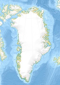
Milneland ( Danish Milne Land , Greenland. Ilimananngip Nunaa ) is a large, uninhabited island in eastern Greenland . Administratively, it belongs to the Ittoqqortoormiit district of the Kommuneqarfik Sermersooq municipality . The island was discovered and mapped for Europe by William Scoresby , who named it after Sir David Milne (1763-1845), a British admiral.
geography
With an area of around 3900 km², Milneland is the third largest island in the autonomous nation of Greenland after the main island of Greenland and Disko Island . The rugged and largely glaciated island is 113 km long and up to 45 km wide; its highest point is given as 2100 meters above sea level. It lies deep to the west of Scoresbysund , the largest fjord complex in the world, and is surrounded on three sides by mainland Greenland. It is separated from this by the waters of Hall Bredning, Fønfjord, Røde Fjord and Øfjord. Milneland forms an archipelago with the much smaller islands Storø, Sorteø, Bjørne Øer, Danmark Ø ( Ujuaakajiip Nunaa ) and Rødeø . Milneland is around 100 km away from the nearest settlement, Ittoqqortoormiit (Danish Scoresbysund ) at the eastern end of the fjord.
See also
Individual evidence
- ↑ Milne Land . In: Anthony K. Higgins: Exploration history and place names of northern East Greenland. (= Geological Survey of Denmark and Greenland Bulletin 21, 2010). Copenhagen 2010, ISBN 978-87-7871-292-9 , accessed January 1, 2014 (English)
- ↑ UNEP Islands (English)
- ↑ Milneland im peakbagger (English)

