
Dawes (moon crater)
| Dawes | ||
|---|---|---|

|
||
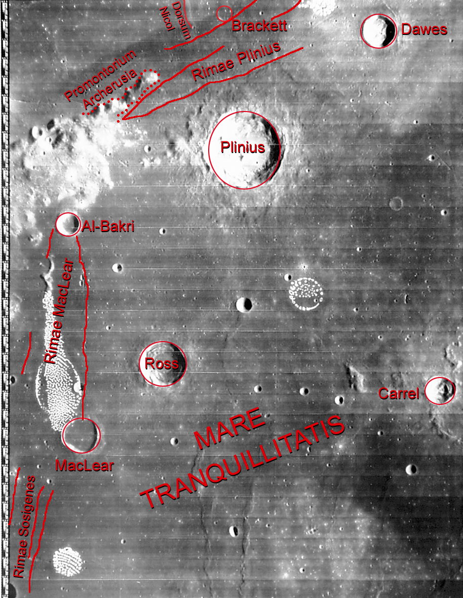
| Dawes and the surrounding area (bottom left; LROC- WAC) | ||
|
||
| position | 17.21 ° N , 26.34 ° O | |
| diameter | 18 km | |
| depth | 2310 m | |
| Card sheet | 42 (PDF) | |
| Named after | William Rutter Dawes (1799–1868) | |
| Named since | 1935 | |
| Unless otherwise stated, the information comes from the entry in the IAU / USGS database | ||


Dawes is an impact crater northeast of Pliny Crater in the wide strait between the Mare Serenitatis and Mare Tranquillitatis . The slopes of Mons Argaeus rise to the northeast . The circular crater shows a slightly flattened outline and a sharp crater rim. It has a slight elevation in the center and its somewhat darker colored floor is almost entirely covered with overlapping vortex-like deposits. The majority of these deposits are made up of fallen or slipped material. The inner crater walls are steep and show no signs of erosion.
Closer investigations have found apparent niches and gullies on the crater rim. According to the assumptions, the impacts of micrometeorites on the crater rim trigger landslides that create a channel-shaped structure. Similar appearances can also be found on the inside of some craters on Mars , with the same causes being assumed.
The Rima Dawes moon groove runs northwest of Dawes .
Individual evidence
- ^ John Edward Westfall: Atlas of the Lunar Terminator. Cambridge University Press, Cambridge 2000, ISBN 0-521-59002-7 , p. 273
Web links
- Dawes in the Gazetteer of Planetary Nomenclature of the IAU (WGPSN) / USGS
- Dawes crater in the "Digital Lunar Orbiter Photographic Atlas of the Moon"