Derwent Water
| Derwent Water | ||
|---|---|---|

|
||
| Dusk over the lake | ||
| Geographical location | England | |
| Tributaries | Derwent , Watendlath Beck | |
| Drain | Derwent | |
| Data | ||
| Coordinates | 54 ° 34 '46 " N , 3 ° 8' 48" W | |
|
|
||
| length | 4.4 km | |
| width | 1.6 km | |
| Maximum depth | 22 m | |
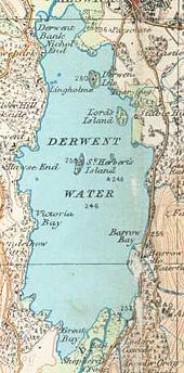
Derwent Water is the fourth largest lake in England and is located in the Lake District in Cumbria .
The lake is at the lower end of Borrowdale just south of the small town of Keswick . It is 4.4 km long and up to 1.6 km wide. The deepest point is 22 meters below the lake level, the area is 5.2 km². There are four small islands in the lake that are owned by the National Trust and one of which is inhabited.
Like the other lakes in the Lake District, Derwent Water is also located in a trough valley created during the Würm glacial period . The main tributary and outflow is the Derwent , which also flows through Bassenthwaite Lake , five kilometers to the north . It is believed that Derwent Water and Bassenthwaite Lake used to form a single lake; Since then, however, debris has settled in between and forms the basis for a fertile alluvial plain .
The lake is considered to be extremely scenic. It is surrounded by hills, locally called fells , and the slopes near the shore are densely forested. An excursion boat runs between different landing stages. There are four boat harbors, two in Portinscale , one in Keswick and one at the southern end by the Lodore Falls . There is an extensive network of hiking trails around the entire lake and in the surrounding area.


