Deverall Island
| Deverall Island | ||
|---|---|---|
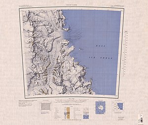
| Topographic map with Beaumont Bay and Deverall Island (center) | ||
| Waters | Beaumont Bay | |
| Geographical location | 81 ° 28 ′ 0 ″ S , 161 ° 54 ′ 0 ″ E | |
|
|
||
| surface | 3 km² | |
| Residents | uninhabited | |
Deverall Island is a small and icy island in the Ross Dependency of Antarctica . Off the Shackleton coast , it lies in the northeastern part of Beaumont Bay and is completely enclosed by the Ross Ice Shelf .
Participants of the 1960 to 1961 campaign as part of the New Zealand Geological Survey Antarctic Expedition named them after William Harold Deverall (1924-2011), New Zealand radio operator at Scott Base in 1961.
Web links
- Deverall Island in the Geographic Names Information System of the United States Geological Survey .
- Deverall Island on geographic.org (English).

