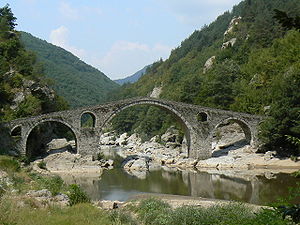
Djawolski most
Coordinates: 41 ° 37 ′ 14 ″ N , 25 ° 6 ′ 51 ″ E
| Djawolski most | ||
|---|---|---|
| The "Devil's Bridge" over the Arda | ||
| use | pedestrian | |
| Crossing of | Arda | |
| place | Ardino ( Bulgaria ) | |
| construction | Arch bridge | |
| overall length | 56 m | |
| width | 3.5 m | |
| Number of openings | 3 | |
| height | 11.5 m | |
| start of building | 1515 AD | |
| completion | 1518 AD | |
| construction time | 3 years | |
| planner | Dimitar | |
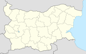
| location | ||
|
|
||
Djawolski most ( Devil's Bridge; Bulgarian: Дяволски мост; Turkish: Şeytan Köprüsü ) is a three-arched stone bridge that crosses the Arda River in the Bulgarian Rhodope Mountains near Ardino in Kardzhali Oblast . In 2013 a 5 km long asphalt driveway was created.
Emergence
The 56 m long, 3.5 m wide and 11.5 m high bridge, part of the connection from Thrace to the coast of the Aegean Sea , was built from 1515 to 1518 under the reign of the Ottoman Sultan Selim I, possibly in place of one in Roman times previous building built by the builder Dimitar . In 1984 it was declared a cultural monument ( паметник на културата ). The long-distance hiking trail Sultans Trail leads over the bridge .
Individual evidence
Web links
Commons : Djawolski most - collection of images, videos and audio files


