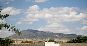
Djebel Bargou
| Djebel Bargou | ||
|---|---|---|
|
Djebel Bargou from the southwest |
||
| height | 1266 m | |
| location | Tunisia | |
| Coordinates | 36 ° 3 '34 " N , 9 ° 36' 31" E | |
|
|
||
The Djebel Bargou ( Arabic جبل برقو) is a mountain range up to 1266 m high in the Siliana Governorate in northern Tunisia .
location
The approximately 8 km long mountain range of Djebel Bargou is located about 100 km (as the crow flies) southwest of Tunis or about 20 km east of the provincial capital Siliana . To the east it is accompanied by the significantly longer, but only slightly higher Djebel Serj at 1357 m .
geology
The limestone mountains running from southwest to northeast are one of the numerous northeastern foothills of the Atlas Mountains , which in their entirety are also called the 'Tunisian Ridge' ( dorsal tunisia ).
Ascent
It is possible to climb the mountain range; however, it is seldom undertaken due to the prevailing heat. In the karst, but partly wooded slopes of the mountain there are many caves in which bats also find shelter. Feral cattle, wild boars and foxes also live here.
Attractions
Hewn stones from an ancient oil press and the abandoned village of Bhirine are best found and explored with a local guide.

