Doi Suthep (mountain)
| Doi Suthep | ||
|---|---|---|
| height | 1676 m | |
| location | Chiang Mai Province , Northern Thailand | |
| Mountains | Daen Lao mountain range | |
| Coordinates | 18 ° 48 '46 " N , 98 ° 53' 37" E | |
|
|
||
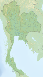
The Doi Suthep is a 1,676 m high mountain in the province of Chiang Mai in northern Thailand . Doi Suthep is located west of the city of Chiang Mai in the Doi Suthep-Doi Pui National Park .
Doi Suthep is part of the Daen-Lao mountain range , which stretches over a length of 200 kilometers along the northern border of Thailand. The mountains form the watershed between the Saluen and Mekong systems . The water of the northern flank flows directly into the Saluen, while the water of the southern flank partly drains to the southwest, where the Mae Nam Pai breaks its way through the chain and flows into the Saluen, and partly into the system of Mae Nam Ping and thus ultimately in the Mae Nam Chao Phraya . The Daen-Lao mountain range begins at Chiang Saen in the east. The western end is not clearly defined, geographers usually include the mountain range of the highest mountain in Thailand, Doi Inthanon . In addition to the Doi Suthep with a height of 1676 meters, elevations such as the Doi Pui (1685 meters height), the Doi Luang Chiang Dao (2175 meters height) and the Doi Inthanon with 2567 meters are part of this mountain range.
On the eastern slopes of Doi Suthep is the Wat Phra That Doi Suthep , a Buddhist temple complex ( Wat ) , visible from afar , which is Chiang Mai's landmark and is located about 15 kilometers west of the city center.
literature
- Wolf Donner: The Five Faces of Thailand . Institute of Asian Affairs, Hamburg 1978, Paperback Edition: University of Queensland Press, St. Lucia, Queensland 1982, ISBN 0-7022-1665-8

