
Mae Nam Chao Phraya
|
Mae Nam Chao Phraya Chao Phraya |
||
 Origin of the Chao Phraya in Nakhon Sawan |
||
| Data | ||
| location | Thailand | |
| River system | Chao Phraya | |
| origin | Confluence of the Nan and Ping rivers in Nakhon Sawan 15 ° 42 ′ 2 ″ N , 100 ° 8 ′ 27 ″ E |
|
| muzzle |
Gulf of Thailand , Samut Prakan Province Coordinates: 13 ° 32 ′ 25 " N , 100 ° 35 ′ 23" E 13 ° 32 ′ 25 " N , 100 ° 35 ′ 23" E |
|
| Mouth height |
0 m
|
|
| length | 372 km | |
| Catchment area | 160,000 km² | |
| Drain |
MQ |
883 m³ / s |
| Left tributaries | Mae Nam Pa Sak | |
| Reservoirs flowed through | Chao Phraya Dam | |
| Big cities | Bangkok | |


The Mae Nam Chao Phraya ( Thai แม่น้ำ เจ้าพระยา , pronunciation: [ mɛ̂ː náːm t͡ɕâw pʰráʔjaː ]; Mae Nam means "river") or just Chao Phraya is the largest and most important river in Thailand next to the Mekong .
It begins at the confluence of the Ping and Nan Rivers in Nakhon Sawan . Other important tributaries of the Chao Phraya system are the Yom , the largest tributary of the Nan, which runs almost parallel to it from Phitsanulok to Chum Saeng north of Nakhon Sawan (only a few kilometers from the origin of the Chao Phraya), and the Wang , which ends in the ping at Tak Ok ( Tak Province ).
The Chao Phraya flows from Nakhon Sawan through the central lowlands about 370 kilometers to Bangkok , where it flows into the Gulf of Thailand at the junction of the Indochinese and Malay peninsulas . At Chai Nat , the river divides into the main arm and the narrower Mae Nam Tha Chin (Tha Chin River), which flows into the Gulf of Thailand at Samut Sakhon about 35 km west of Bangkok. The Chao Phraya Dam is also located in Chai Nat .
In addition to Bangkok, the old capital Ayutthaya and the smaller provincial capitals Uthai Thani , Chai Nat , Sing Buri , Ang Thong , Pathum Thani , Nonthaburi and Samut Prakan are on the Chao Phraya. It is an important traffic artery in Thailand and also serves with many canals ( khlongs ) for irrigation of the rice-growing areas .
history
On historical maps, the Chao Phraya is usually only referred to as "Menam", also "Mae Nam", which is the Thai word for river . In the English-speaking world, it is also often called the River of Kings due to its historical significance .
In feudal Siam, Chao Phraya was a high nobility title , translatable as duke or margrave , whose holder served as minister of state or governor of an important city. The English geographer James Fitzroy McCarthy stated in his records in 1900 that the name means that it is the main river in the country.
The current course of the lower Chao Phraya was only established in the middle of the 19th century. In the past, the river often looked for a new bed after the annual flooding, for example south of Chai Nat down to Ang Thong a former river course can be seen, which is located a few kilometers west of today's river. Siamese engineers later tried to influence the course: they built a dam at Ang Thong in 1813 to straighten the course of the river as far as Ayutthaya. The dam broke repeatedly, so this project was eventually abandoned.
The engineers south of Ayutthaya were more successful: from 1538 to 1722, by building canals, they were able to shorten the distances that merchant ships had to cover from the Gulf of Siam to the capital Ayutthaya by 62.3 kilometers:
- First in 1538 a three-kilometer-long so-called Khlong Lat (Thai: คลอง ลัด - "abbreviation channel") was dug, which connected Wat Chalo ( ⊙ - Amphoe Bang Kruai , Nonthaburi ) with Wat Khee Lek ( ⊙ - Bangkok Noi district ). The canal called “Khlong Lat Bang Kruai” shortened the route by about 13-14 kilometers. Today it is part of the Khlong Bangkok Noi .
- The second Khlong Lat has great significance for Siamese history because it created the geographical features that ultimately led to the founding of Bangkok and Thonburi. There are contradicting information about the exact date, both 1538 and 1542. The two-kilometer-long canal began around the former train station in Bangkok Noi ( ⊙ - Bangkok Noi district ) and led to a point just south of Wat Arun ⊙ . The river quickly accepted this shortcut, so the canal looks like the correct course of the river today. The original course gradually silted up; it is now called Khlong Bangkok Yai . This canal, called “Khlong Lat Bangkok”, shortened the distance to Ayutthaya by about 14 kilometers.
- The third abbreviation, the "Khlong Lat Kret Yai", was dug in 1608 at Pathum Thani ( ⊙ to ⊙ ). He shortened 18 kilometers to seven. The northern part of the original river bed is now called "Khlong Bang Phrao", the southern "Khlong Bang Luang".
- In 1636 "Khlong Lat Mueang Nonthaburi" was created ( ⊙ to ⊙ ), which saved 17 from a distance of formerly 22 kilometers.
- "Khlong Lat Kret Noi" from 1722 shortened six kilometers of river to two ( ⊙ to ⊙ ). He created today's island of Ko Kret .
- The sixth Khlong Lat runs south of Khlong Toei in the Amphoe Phra Pradaeng ( ⊙ to ⊙ ). The 600 meter long canal should actually save 19 kilometers. Since the Chao Phraya is dependent on the tides , it soon became apparent that the new channel caused salt water to penetrate far too far to the north and damage life in and around the river. In 1784 a dike was built to prevent seawater from entering. Today the "Khlong Pak Lat" is the only canal that did not become part of the river's course.
- The German botanist Johann Gerhard König took a trip on the Chaophraya in November 1778 and reports of numerous crocodiles that swam in the river during the day and made horrific noises. There is also talk of an incredible number of monkeys. However, both are no longer mentioned by travelers in the late first half of the 19th century, so they seem to have been expelled at the end of the 18th and early 19th centuries.
Impressions of the river course
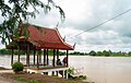
Ang Thong : View from Wat Tha Sutthawat over the river

Bangkok: Rama VIII Bridge over the Chao Phraya

Bangkok: Phra Phutthayotfa Bridge

Mouth of the Chao Phraya in Samut Prakan

Hustle and bustle on the river in Bangkok


.JPG)
Important bridges in Bangkok
- Rama VI Bridge - Railway Bridge on the Southern Railway Line, near Nonthaburi
- Rama VIII Bridge - asymmetrical suspension bridge, only inaugurated in May 2002, today one of the most important traffic connections to Thonburi
- Phra Pinklao Bridge - north of Sanam Luang , extension of Ratchadamnoen Boulevard
- Phra Phutthayotfa Bridge ( Saphan Phut or "Memorial Bridge") - the first bridge between Bangkok and Thonburi, inaugurated on the 150th anniversary of the founding of Bangkok
- Krungthep Bridge - opened on June 25, 1959 as the second bridge over the Chao Phraya ( Bang Kho Laem district )
- Rama IX Bridge - Bridge on the Chalerm Maha Nakhon Expressway in Yannawa District
- Bhumibol Bridge (also: "Mega Bridge") - has spanned the Chao Phraya, whichforms a large loopin the Phra Pradaeng district, in two placessince September 2006; Part of the planned Industrial Ring Road .

See also
literature
- Steve Van Beek: The Chao Phya, River in Transition . Oxford University Press, Kuala Lumpur 1995, ISBN 967-65-3069-7 .
- William Warren, R. Ian Lloyd: Bangkok's Waterways . Asia Books, Bangkok 1989, ISBN 981-00-1011-7 .
Movie
- 360 ° geo-report. Bangkok's treasure divers. Documentary, Germany, 2013, 43 min., Script and director: Martin Schacht, production: MedienKontor FFP, GEO , arte , series: 360 ° - Geo -Reportage, first broadcast: April 26, 2014 on arte, table of contents with the beginning of the film by GEO.
Web links
Individual evidence
- ↑ Card of the "Menam of Siam to the sea" , from the book A new historical relation of the kingdom of Siam by Simon de La Loubere (1680); Online presentation at "Southeast Asia Visions"
- ^ Whitaker's Peerage, Baronetage, Knightage and Companionage, 1910, p. 182.
- ↑ Rong Syamananda: A history of Thailand. 1986, p. 38
- ↑ James Fitzroy McCarthy: Surveying and Exploring in Siam. John Murray, London 1900, p. 21.
- ↑ Steve Van Beek: The Chao Phya , p. 11
- ↑ Steve Van Beek: The Chao Phya , p. 39
- ^ Barend Jan Terwiel : Through Travelers' Eyes: an approach to nineteenth-century Thai history . Bangkok: Duang Kamol 1989. ISBN 974-210-455-7 .