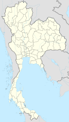
Ang Thong
|
เทศบาล เมือง อ่างทอง Ang Thong |
||
|---|---|---|
|
|
||
| Coordinates | 14 ° 35 ' N , 100 ° 27' E | |
| Basic data | ||
| Country | Thailand | |
| Ang Thong | ||
| ISO 3166-2 | TH-15 | |
Ang Thong ( Thai อ่างทอง ) is a Thesaban Mueang ( เทศบาล เมือง อ่างทอง - "city") in Ang Thong Province . Ang Thong Province is located in the central region of Thailand .
etymology
Ang Thong comes from อ่าง “bowl” or “basin” and ทอง “golden”, which means something like golden bowl .
geography
Ang Thong is located on the Mae Nam Chao Phraya (Chao Phraya River) in the middle of the fertile central plain. Accordingly, intensive rice cultivation dominates the area around the city. During the Ayutthaya period , the city was on the other bank of the Chao Phraya and was moved to its current location on the orders of King Taksin because there is more fertile area there. It was at this time that it was given its current name.
Ang Thong is located a little more than 100 km north of the capital Bangkok in the Amphoe (approximately: "Landkreis" - administrative district) Mueang Ang Thong .
Economy and Importance
Ang Thong's main product is rice . The products of regional handicrafts are also sold here, in particular small dolls and hand drums of various sizes that are made in the surrounding districts. In Amphoe Mueang, the provincial capital itself, wickerwork, artificial flowers, small ceramics and dried bananas are sometimes produced in cooperatives.
history
Ang Thong was an important outpost of the Ayutthaya kingdom , particularly during the early Ayutthaya period . Here the capital was mainly defended against the numerous Burmese invasion attempts.
See also: History of Thailand .
Attractions
- Wat Ang Thong Worawihan - Buddhist temple complex ( Wat ) on the banks of the Mae Nam Chao Phraya ; originally two separate temples, Wat Pho Ngoen and Wat Pho Thong, which were built during the reign of King Mongkut (Rama IV) and which were rebuilt under King Chulalongkorn (Rama V), so that a larger one was created.
Personalities
- Nont Muangngam (born 1997), soccer player
Web links
- City map of Ang Thong (names in Thai and English - last accessed November 29, 2015)
