Dott Ice Rise
Coordinates: 79 ° 17 ′ S , 81 ° 41 ′ W
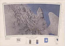
The Dott Ice Rise is an ice dome in West Antarctica . The peninsula-like elevation, almost completely covered by ice, is about 20 nautical miles (37 km) long and extends east of the Heritage Range , the southern part of the Ellsworth Mountains , to the ice-filled Constellation Inlet on the southwestern edge of the Filchner-Ronne Ice Shelf . It is connected to the eastern side of Pioneer Heights via the Johnson Neck Isthmus . The Barrett nunatakker are the only part of the ice dome that protrudes above the ice.
The Dott Ice Rise was mapped by the United States Geological Survey as part of the mapping of the Heritage Range from 1961 to 1966 through field surveys and aerial photographs by the United States Navy . The Advisory Committee on Antarctic Names named the ice dome after the geologist of the United States Antarctic Program Robert H. Dott , who was the chief representative of the United States at the Chilean research station Bernardo O'Higgins in the summer of 1961/62 .
Individual evidence
- ↑ a b c Dott Ice Rise ( English ) In: Geographic Names Information System . United States Geological Survey . Retrieved July 16, 2010.
- ^ Johnson Neck ( English ) In: Geographic Names Information System . United States Geological Survey . Retrieved July 16, 2010.

