Ellsworth Mountains
| Ellsworth Mountains | |
|---|---|
|
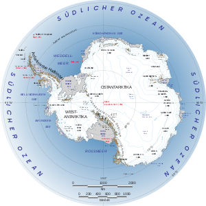
General map of the Antarctic with the Ellsworth Mountains |
|
|
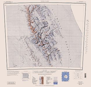
Map sheet with Ellsworth Mountains |
|
| Highest peak | Mount Vinson ( 4892 m ) |
| location | Ellsworthland , West Antarctica |
| Coordinates | 78 ° 45 ′ S , 85 ° 0 ′ W |
| surface | 17,500 km² |
The Ellsworth Mountains ( Engl. Ellsworth Mountains ) are the highest mountains in Antarctica . It extends in north-south orientation over a length of about 350 km, is about 50 km wide and is located on the western edge of the Filchner-Ronne ice shelf in the West Antarctic Ellsworthland . In addition to a number of other four-thousand-meter peaks, it contains Mount Vinson , Antarctica's highest mountain at 4892 m .
The Ellsworth Mountains are divided into two main chains by the Minnesota Glacier , the more northerly Sentinel Range and the Heritage Range .
The highest mountains in the Ellsworth Mountains, all of which are part of the Sentinel Range, are:
| summit | height |
|---|---|
| Mount Vinson | 4892 m |
| Mount Tyree | 4852 m |
| Mount Shinn | 4661 m |
| Mount Craddock | 4368 m |
| Mount Gardner | 4587 m |
| Mount Epperly | 4359 m |
Geologically, the mountain range forms a unit with the Whitmoregebirge as the Ellsworth Whitmore Mountains Block .
The American polar explorer Lincoln Ellsworth discovered the mountain range on November 23, 1935 on the first transantarctic flight from Dundee Island to the Ross Ice Shelf and initially named it Sentinel Range (from English sentinel , guardian ). When it turned out in the course of mapping by the USGS that they were two separate chains, the original name was limited to the higher northern one, the southern Heritage Range and the entire mountain range named after the discoverer.
literature
- Gerald F. Webers, Campbell Craddock, John F. Splettstoesser: Geology and paleontology of the Ellsworth Mountains, West Antarctica . Geological Society of America , Boulder (Colorado) 1992, ISBN 0-8137-1170-3 (American English, [1] ).

