Sentinel Range
| Sentinel Range | ||
|---|---|---|
| Highest peak | Mount Vinson ( 4892 m ) | |
| location | Ellsworthland , West Antarctica | |
| part of | Ellsworth Mountains | |
|
|
||
| Coordinates | 78 ° 10 ′ S , 85 ° 30 ′ W | |
|
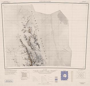
Topographic map sheet of the Sentinel Range (North) |
||
|
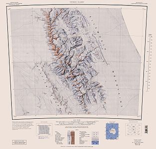
Topographic map sheet of the Sentinel Range (South) |
||
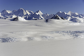
The Sentinel Range is the northern half of the Ellsworth Mountains in the West Antarctic Ellsworthland . It extends in a north-northwest-south-southeast orientation, is around 185 km long, 50 km wide and separated from the southern Heritage Range by the Minnesota Glacier .
The mountain range was first sighted and photographed from the air by Lincoln Ellsworth on November 23, 1935 . The members of the Marie Byrd Land Traverse Expedition led by Charles Bentley in 1958 were the first explorers in the region. The first mapping was done 1958-1961 by the United States Geological Survey with the help of aerial photographs of the United States Navy .
The Sentinel Range is the highest mountain range in Antarctica, here is also the highest mountain on the continent, the 4892 m high Mount Vinson . The highest mountain on the continent that does not belong to the Sentinel Range is Mount Kirkpatrick, 4528 meters high . It is about 1500 kilometers away in the Queen Alexandra chain .
The Sentinel Range includes:
| summit | height |
|---|---|
| Mount Vinson | 4892 m |
| Mount Tyree | 4852 m |
| Wahlstrom Peak | 4677 m |
| Mount Shinn | 4661 m |
| Mount Epperly | 4602 m |
| Mount Gardner | 4587 m |
| Mount Craddock | 4368 m |
Web links
- Sentinel Range in the Geographic Names Information System of the United States Geological Survey (English)
- Sentinel Range on geographic.org (English)


