Duke Point Ferry Terminal
| Duke Point Ferry Terminal | |||
|---|---|---|---|
| Data | |||
| Port type | Sea port / ferry port | ||
| Piers / quays | 1 | ||
| Geographic information | |||
| place | Nanaimo | ||
| province | British Columbia | ||
| Country | Canada | ||
| Aerial view of the Duke Point ferry terminal | |||
| Coordinates | 49 ° 9 '39 " N , 123 ° 53' 33" W | ||
|
|||
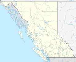
The Duke Point Ferry Terminal is a ferry terminal in the Canadian province of British Columbia . It is located on the Northumberland Channel , a branch of the Strait of Georgia , near the city of Nanaimo in the Regional District of Nanaimo, and the tidal range here is usually between 1 and 4 meters. Among other things, the ferry port is the southern starting point of Highway 19 .
BC Ferries ( British Columbia Ferry Services Inc. ), as the main operator of the ferry connections on the west coast of British Columbia , operates various routes from here.
After the Coastal Inspiration ferry collided with the pier, the terminal was out of service from December 20, 2011 to April 30, 2012. The connection to Vancouver (via Tsawwassen) was operated via the Departure Bay Ferry Terminal at this time . The repair cost was C $ 2.2 million.
Routes
The following goals are currently being approached from here:
- Vancouver (via Tsawwassen )
Web links
Individual evidence
- ^ Nanaimo (# 7917) Tidal Prediction. Fisheries and Oceans Canada , accessed April 29, 2016 .
- ↑ BC Ferries of April 23, 2012 BC Ferries Duke Point Terminal to RE-OPEN on May 1 , English
- ↑ Times Colonist of April 23, 2012 Repaired Duke Point ferry terminal to reopen May 1 ( Memento of the original of April 28, 2012 in the Internet Archive ) Info: The archive link was automatically inserted and not yet checked. Please check the original and archive link according to the instructions and then remove this notice. , English

