Eichendorfer Weiher
| Eichendorfer Weiher | ||
|---|---|---|

|
||
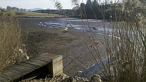
| Pond with drained water | ||
| Geographical location | Bavaria , Germany | |
| Location close to the shore | Weilheim in Upper Bavaria | |
| Data | ||
| Coordinates | 47 ° 47 '47 " N , 11 ° 15' 14" E | |
|
|
||
| Altitude above sea level | 659 m | |
| length | approx. 280 m | |
| width | approx. 140 m | |
The Eichendorfer Weiher is a natural body of water in the Upper Bavarian municipality of Eberfing near the hamlet of Eichendorf . It is actually not a pond , but a small lake . Today the pond is used for recreation, fish farming and fishing.
geography
The nearly three hectare large Himmelsteich is located immediately west of Eichendorf in an ice age excavation below the terminal moraines Leitenbichel (707 m) and Moosberg (670 m).
It is fed exclusively by precipitation and groundwater infiltration and has no natural, superficial inflow or outflow. To the south, there is now a marsh area of about one hectare, which originally also belonged to the lake area and can now be drained into a nameless infiltration stream.
history
Historical findings in the swampy area do not begin until around the year 1,000. An Aichendorf is mentioned for the first time there from 1200. Around 1485, three Benediktbeurer courtyards and the pond at Eichendorf were left to the ducal hunter Hans Wagner (presumably for a long lease). In the late 17th century, still in its natural size, it belonged to the property of Count Arco .
Sometime between 1808 and 1867 the southern part of the Eichendorfer Weiher was canalised and swamped.
Web links
Individual evidence
- ↑ http://geoportal.bayern.de/bayernatlas/?X=5294768.37&Y=4445239.84&zoom=10&lang=de&topic=ba&bgLayer=tk&catalogNodes=122 Bayernatlas
- ↑ Angling at Eichendorfer Weiher ( Memento of the original from January 20, 2016 in the Internet Archive ) Info: The archive link was automatically inserted and not yet checked. Please check the original and archive link according to the instructions and then remove this notice.
- ↑ Eichendorfer Weiher on a historical map
