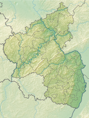
Eicher lake
| Eicher lake | ||
|---|---|---|

|
||
| Eicher lake | ||
| Geographical location | Alzey-Worms district , Rheinhessen , Rhineland-Palatinate , Germany | |
| Tributaries | Rhine | |
| Drain | to the Rhine | |
| Location close to the shore | Calibration | |
| Data | ||
| Coordinates | 49 ° 45 '39 " N , 8 ° 26' 47" E | |
|
|
||
| Altitude above sea level | 87 m | |
| surface | 58 ha | |
| length | 1.9 km | |
| width | 500 m | |
The Eicher See (also called "Rheinhessisches Meer" or "Rheinhessen's bathtub") is a large quarry pond with access to the Rhine , located on the northeastern edge of the Rhine-Hessian municipality of Eich . With its eastern and northeastern banks, it borders on the municipality of Hamm am Rhein . It is largely surrounded by a weekend house area and has a marina where larger yachts can moor.
The lake is characterized by excellent water quality. It has been released for public use by the responsible Lower Water Authority . The Eicher See offers opportunities for sailing, surfing and fishing.
The adjoining Rhine meadows, with the Rhine-Hessian wine landscapes beginning nearby with their many wine villages, also offer excellent recreational qualities.
Web links
- Bathing lake Eich on the website of the Eicher local community
Individual evidence
- ↑ Ordinance on the regulation of common use at the "Eicher See" from June 27, 1977 by the Alzey-Worms district administration (PDF; 13 kB). Retrieved November 24, 2015
