
el-Qusaima
Coordinates: 30 ° 40 ′ 8 ″ N , 34 ° 22 ′ 0 ″ E

El-Qusaima (also Quseima , Arabic القسيمة, DMG al-Qusaima ) is a place on the Sinai Peninsula . As of the November 11, 2006 census, the town had a population of 2,598.
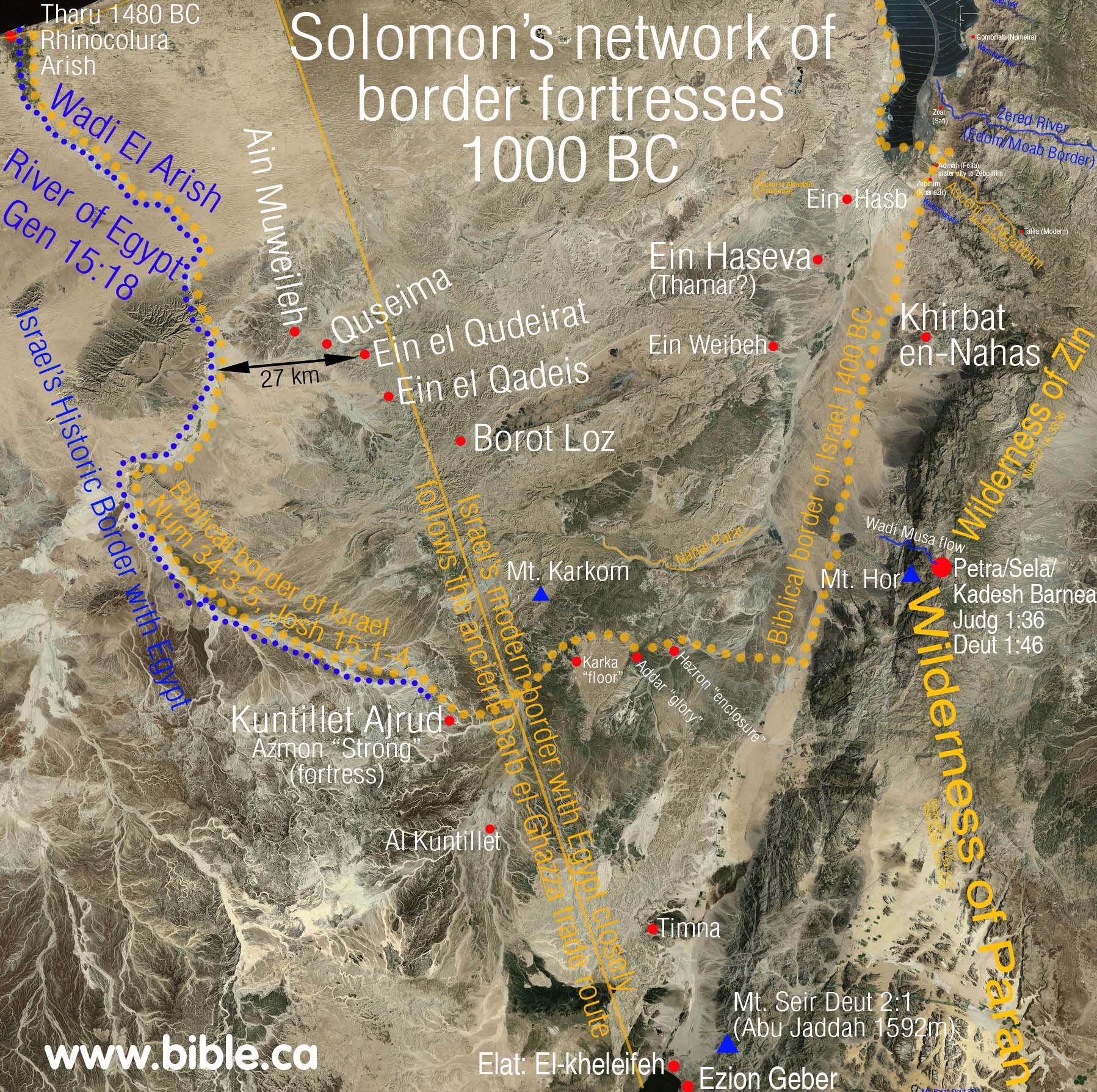
Possibly the place can be identified with the biblical Azmon (Hebrew עצמון, place of bones). According to the biblical representation (Num 34,4f. And Jos 15,4) Azmon was on the southern border of the tribe of Judah to Egypt.
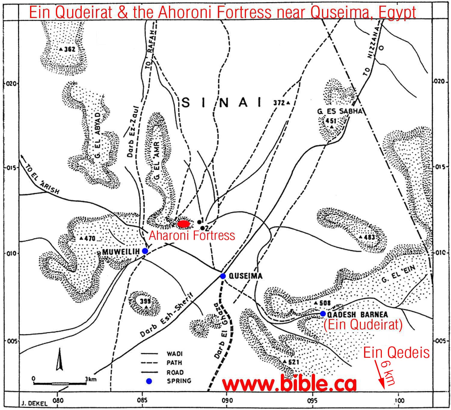
The biblical place Kadesch Barnea is about 14 km southeast of Ein el-Qudeirat or Ein el-Qedeisch .
About 3 km to the northwest is the so-called Aharoni Fortress . In the south of this fortress is the source Muweileh (also Muweilih ). It is possibly identical to Beer-lahai-roi .
In El-Qusaima, the branch line Maṣʿūdiyya – Sinai of the Ottoman military railway, which was laid during the First World War, ended in 1916 , but this section was discontinued in 1917.
Individual evidence
- ↑ Population figures according to the Egyptian census of 2006 ( memento from August 15, 2012 on WebCite ), viewed on June 11, 2014.
- ↑ http://www.aegyptologie.com/forum/attachments/Kadesch-Barnea.pdf
- ↑ Lexicon for the Bible by Fritz Rienecker, Gerhard Maier
- ↑ Places and Landscapes of the Bible.
- ↑ http://www.bible.ca/archeology/bible-archeology-exodus-kadesh-barnea-negev-border-fortress-network.jpg
- ↑ Zeev Meshel: The "Aharoni Fortress" near Quseima and the "Israelite Fortresses" in the Negev . In: Bulletin of the American Schools of Oriental Research 294 (1994), pp. 39-67; resulting map .
- ↑ http://www.christiananswers.net/dictionary/beer-lahai-roi.html
- ↑ Walter Rothschild , Arthur Kirby and the last years of Palestine Railways: 1945–1948 , Berlin: Selbstverlag, 2009, also King's College London Diss., 2009, footnote 78, p. 27. OCLC 495751217