El Toco
| El Toco or Cerro Toco | ||
|---|---|---|
|
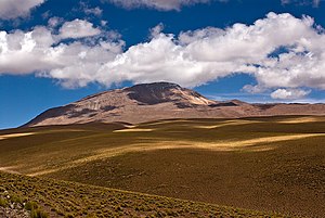
El Toco as seen from the San Pedro de Atacama driveway |
||
| height | 5604 m | |
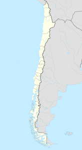
| location | Antofagasta region , Chile | |
| Mountains | To the | |
| Coordinates | 22 ° 56 '24 " S , 67 ° 46' 49" W | |
|
|
||
| Type | Stratovolcano | |
The Cerro Toco , or mostly simply El Toco , is a 5604 m high inactive stratovolcano in the east of the Atacama Desert in the Chilean region II (Antofagasta) . It is located about 6 km south of the border with Bolivia and about 12 km southeast of the neighboring Licancabur volcano with its memorable shape. Due to its proximity to the tourist center of San Pedro de Atacama (approx. 60 km) it is a popular destination for guided day tours. For this purpose, visitors are usually driven to an altitude of around 5000 m in order to ascend and descend from there in a technically simple half-day tour to the summit. However, due to the altitude, adequate acclimatization is recommended to prevent altitude sickness . At almost 5200 m there is an astronomical observatory with the Atacama Cosmology Telescope .

