Elk Mountains (Colorado)
| Elk Mountains | ||
|---|---|---|
|
Capitol Peak ( 4307 m ) |
||
| Highest peak | Castle Peak ( 4352 m ) | |
| location | Colorado (USA) | |
| part of | Rocky mountains | |
|
|
||
| Coordinates | 39 ° 1 ′ N , 106 ° 51 ′ W | |
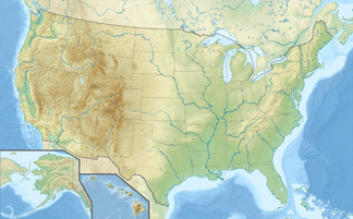
The Elk Mountains are a mountain range in the southern Rocky Mountains in the US state of Colorado . The mountain range lies in the Counties Pitkin and Gunnison and runs over a length of approx. 80 km in a NW-SE direction. The Elk Mountains are bounded by the Roaring Fork River in the north, the Sawatch Range in the east, the West Elk Mountains in the southwest and the Crystal River in the west.
geology
In the area of today's Elk Mountains there was a very warm and humid climate in the Carboniferous Age . During this time, the coal seams , which are today in the western and southern part of the mountain range, have their origin. The Elk Mountains were created as part of the Laramian mountain formation . There was a rise of magma , especially in the eastern half of the mountain range , from which ore deposits formed. This section of the Elk Mountains is part of the Colorado Mineral Belt . The occurrence of silver ore in particular caused a real frenzy in the 1880s and led to the rapid development of the Elk Mountains. Most of these mining locations had disappeared from the map a few decades later.
natural reserve
Large parts of the Elk Mountains are located in the two national forests, White River National Forest and Gunnison National Forest . Furthermore, the two nature reserves Maroon Bells-Snowmass Wilderness and Raggeds Wilderness are part of the mountain range.
Surveys
- Castle Peak 4352 m
- Maroon Peak , 4317 m
- Capitol Peak , 4307 m
- Snowmass Mountain, 4295 m
- Pyramid Peak, 4275 m
- Cathedral Peak, 4252 m
- Treasure Mountain , 4125 m
swell
- ↑ Elk Mountains (English) accessed on February 10, 2010

