It telegraph

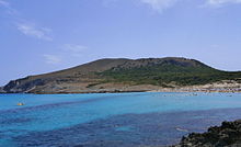
Es Telégraf, view from the west from Cala Mesquida
Es Telégraf is a mountain directly on the northeast coast of the Spanish Mediterranean island of Mallorca .
It reaches a height of 271 meters and belongs to the municipality of Capdepera . At its summit are the ruins of the historic Talaia de Son Jaumell tower and a survey point. The Cap des Freu extends northeast . To the west is the bay of Cala Mesquida , to the east is Cala Moltó . The Puig de s'Àguila rises further to the south-west to which the Es Telégraf is connected via the Coll de Marina saddle .
Narrow mountain paths lead to the top of the mountain from Cala Mesquida and Coll de Marina.
Coordinates: 39 ° 44 ' N , 3 ° 27' E
