Fale (Nukufetau)
| Fale | ||
|---|---|---|
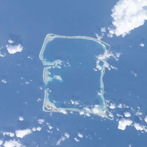
| Satellite image of the Nukufetau Atoll. | ||
| Waters | Pacific Ocean | |
| Archipelago | Nukufetau | |
| Geographical location | 8 ° 2 ′ S , 178 ° 18 ′ E | |
|
|
||
Fale is a motu in the reefs of the Nukufetau atoll in the island state of Tuvalu .
geography
Fale is the westernmost motu together with Motumua , Savave and Temotuloto on the southwest tip of the atoll. The island surrounds the island of Savave to the southwest and has a large population of coconut palms.
history
Tradition has it that Lagitupu and Laupapa , two aliki (chiefs) protected fales from raids from Tonga . Lagitupu and Laupapa built a trap in a place that is still called Tututekolo today. This place was on a path on the way to the beach. There they lay in wait and surprised robbers and stabbed them with their spears or split their skulls with an ax made of shells.
In the late 19th century, after the arrival of the missionaries, the people of Nukufetau lived on Fale before moving to Savave on the inside of the lagoon.
Historical graves have been found on Fale.
Individual evidence
- ↑ Map of Nukulaelae Atoll. Tuvaluislands.com.
- ^ British Admiralty Nautical Chart 766 Ellice Islands. 21 March 1872, United Kingdom Hydrographic Office (UKHO) 1893.
- ↑ geonames.org .
- ↑ a b c Hugh Laracy (ed.) Nofoaiga Lafita: Chapter 12 - Nukufetau . In: Tuvalu: A History . Institute of Pacific Studies, University of the South Pacific and Government of Tuvalu, 1983, pp. 86-87.
- ↑ Hugh Laracy (ed.) Pasoni Taafaki: Chapter 2 - The Old Order . In: Tuvalu: A History . Institute of Pacific Studies, University of the South Pacific and Government of Tuvalu, 1983, p. 26.

