Falkenberg (Wuppertal)
|
Falkenberg
City of Wuppertal
Coordinates: 51 ° 15 ′ 55 ″ N , 7 ° 6 ′ 52 ″ E
|
||
|---|---|---|
| Height : | 256 m above sea level NHN | |
|
Location of Falkenberg in Wuppertal |
||
|
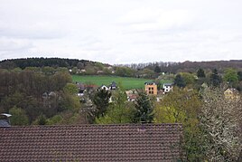
Falkenberg from the Nützenberg
|
||
Falkenberg is a location in the north of the Bergisch city of Wuppertal .
Location and description
The location is on an elevation of 250 m above sea level. NHN on Falkenberg street in the Beek residential area in the Uellendahl-Katernberg district . Neighboring locations are In der Beek , Dorp , Hackland (Elberfeld) and Schörren .
The southern slope and the northwest slope are wooded with deciduous trees and are part of the LSG Hasen- und Falkenberg landscape protection area . On the top of the hill there was a small coniferous forest that had been severely damaged by Hurricane Kyrill .
history
The location arose from a courtyard that is listed as Falkenberg on the Topographia Ducatus Montani by Erich Philipp Ploennies from 1715.
In 1832 the place belonged to the Dorper Rotte of the rural outskirts of the parish and the city of Elberfeld . According to the statistics and topography of the Düsseldorf administrative district , the place, which was categorized as a farmyard and craftsmen's apartments, was called Auf'm Falkenberg and at that time had four residential buildings and eight agricultural buildings. At that time, 74 residents lived in the place, eleven of the Catholic and 63 Protestant faith.
Individual evidence
- ↑ Johann Georg von Viebahn : Statistics and Topography of the Administrative District of Düsseldorf , 1836

