Faro de Punta de Maisí
| Faro de Punta de Maisí | ||
|---|---|---|
| Place: |
|
|
| Location: | Guantanamo Province , Cuba | |
| Geographical location: | 20 ° 14 '38 " N , 74 ° 8' 34.6" W | |
| Fire carrier height : | 31 m | |
| Fire height : | 37 m | |
|
|
||
| Identifier : | Fl.W.5s | |
| Scope knows: | 27 nm (50 km ) | |
| Function: | Sea fire | |
| Construction time: | 1857-1862 | |
| Operating time: | since 1862 | |
| International ordinal number: | J 5018 | |
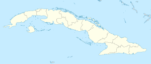
The Faro de Punta de Maisí is a lighthouse on the easternmost tip of the island of Cuba , very close to Baracoa in the Guantánamo province . The construction of the lighthouse was approved in 1856 by the Spanish Queen Isabella II and, after five years of work under the direction of engineer Don Marianao Moreno, it was put into operation in 1862 under the name Faro de Concha .
The Punta de Maisí lighthouse is 31 meters high and made of stones taken from the coast of the region itself. The fire height is 37 meters and a white flash with a return of 5 seconds is shown as an identifier (Fl.W.5s).
See also
Web links
- Russ Rowlett: Lighthouses of Cuba ( English ) In: The Lighthouse Directory . University of North Carolina at Chapel Hill . Retrieved November 10, 2017.
- Faro de Punta de Maisí. Retrieved November 11, 2017 (Spanish).

