Fianga lake
| Fianga lake | ||
|---|---|---|

|
||
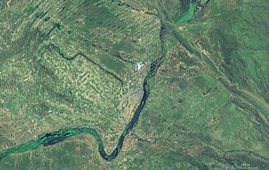
| The Fianga lake (middle) with the connection to the Logone in the northeast, and the connection to the Benue in the southwest. | ||
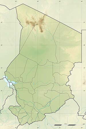
| Geographical location | Mayo-Kebbi Est region , Chad ; Cameroon | |
| Tributaries | Marshes in the east that are fed by the Logone | |
| Drain | about the Logone and the Mayo Kébbi | |
| Islands | about 10 | |
| Places on the shore | Fianga | |
| Data | ||
| Coordinates | 9 ° 58 ′ N , 15 ° 12 ′ E | |
|
|
||
| Altitude above sea level | 321 m | |
| surface | 30 km² | |
| length | 15 km | |
| width | 2 km | |
| Maximum depth | 4 m | |
|
particularities |
Part of the Benue (Niger) and Lake Chad systems |
|
The Lake Fianga is a lake in the Mayo-Kebbi Est Region in the southwest of Chad on the border with Cameroon .
Hydrology
The lake is fed by swamps in the east of the lake that are irrigated by the Logone . It drains in the north through a canal into the Logone and in the south through a canal into the Mayo Kébbi . The lake is located on the watershed between the Chad Basin and the Niger Basin . The water level and the drainage routes are heavily dependent on the water levels of the Logone. The lake has average fluctuations of up to two meters over the year.
Mega Chad

The connection between Logone and Mayo Kébbi via the flood plain, with Lake Fianga in between, corresponds to the outflow from the historic Mega Lake Chad in its maximum extent more than 5,000 years ago. This connection is probably the cause of the occurrence of African manatees in the tributaries of Lake Chad, which is cut off from the sea.
Protected areas
The flood plain of the Longone, from which the Fianga draws its water, was placed under the protection of the Ramsar Convention by Chad under the title Plaines d'inondation du Logone et les dépressions Toupouri .
