
Flat Island (Mauritius)
| Flat Island | |
|---|---|
_1857_map.png) |
|
| Waters | Indian Ocean |
| Archipelago | Mascarens |
| Geographical location | 19 ° 52 ′ 47 " S , 57 ° 40 ′ 5" E |
| length | 1.9 km |
| width | 1.9 km |
| surface | 2.53 km² |
| Highest elevation | 95 m |
 |
|
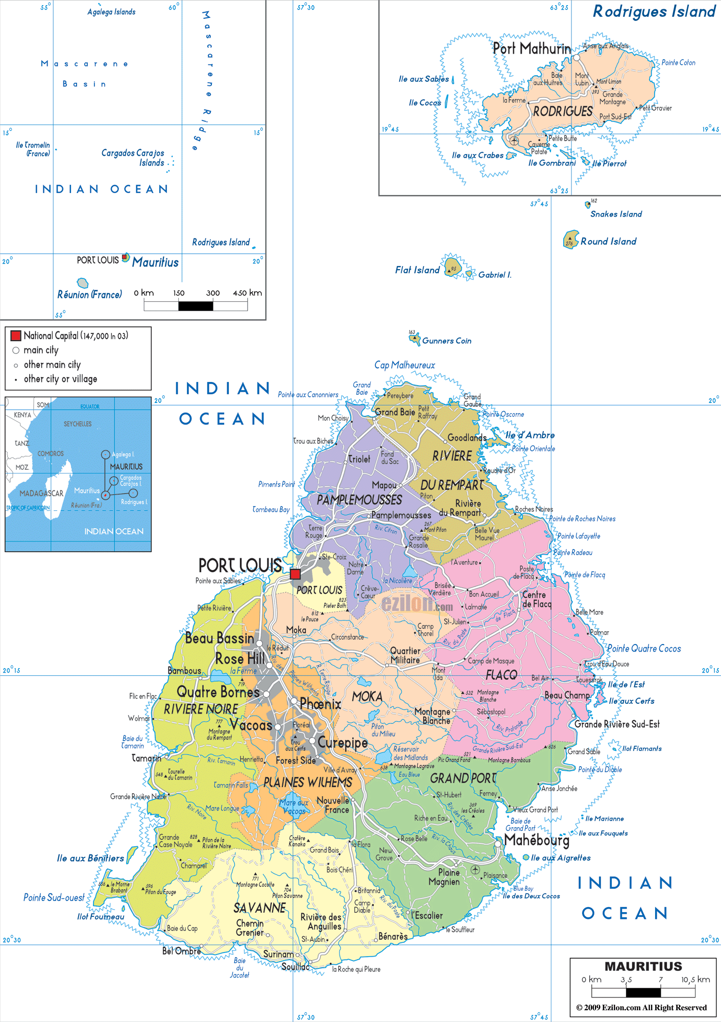
Flat Island , French Île Plate , is an island belonging to the state of Mauritius , about eleven kilometers from Cap Malheureux , the northernmost point of the main island of Mauritius, in the vicinity of the islands of Round Island , Île aux Serpents and Coin de Mire . It has an area of 2.53 km², making it the largest of the immediate sub-islands of Mauritius (excluding the Outer Islands ). It reaches its maximum height of 95 meters in the southwest. There is a lighthouse at this point . The vegetation-free island of Îlot Gabriel is just 300 meters southeast of Flat Island . At low tide it can be reached on foot from Flat Island. Just under 500 meters north is the small rock island Pigeon House Rock (1.2 hectares).
On Flat Island there is one of the two active lighthouses in Mauritius and a cemetery from the 19th century when the island was used by the British as a quarantine island . People who had succumbed to malaria , smallpox or other diseases were buried here.
Today the island is a tourist destination for catamaran trips and diving.
The Nobel Prize for Literature Jean-Marie Gustave Le Clézio has created a literary monument to Flat Island and its past as a quarantine island with his novel A Place Far Away from the World, which is mainly set here .