Siniju Airport
Siniju Airport 신의주 공항 |
||
|---|---|---|
|
|
||
| Characteristics | ||
| Coordinates | ||
| Height above MSL | 7 m (23 ft ) | |
| Transport links | ||
| Distance from the city center | 1.5 km south of Sinŭiju | |
| Start-and runway | ||
| 03/21 | 991 m × 65 m grass | |
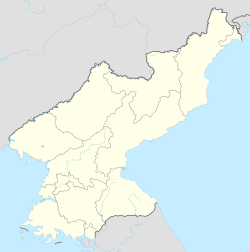
The Sinuiju Airport ( kor. 신의주 공항 ) is located in the south of the North Korean border town of Sinuiju , Province North Pyongan . It was used mainly in the Korean War under the name K-30 by the USAF and was the starting point for various air strikes . There is a runway. Air Koryo is currently (2015) the only user and offers a flight connection to Pyongyang Airport .
Individual evidence
- ↑ Airport Records. In: www6.landings.com. Retrieved September 27, 2015 .
- ^ John Pike: Air Bases - Sinuiju. In: www.globalsecurity.org. Retrieved September 27, 2015 .
