Woodbine Municipal Airport
| Woodbine Municipal Airport | ||
|---|---|---|
|
|
||
| Characteristics | ||
| ICAO code | KOBI | |
| Coordinates | ||
| Height above MSL | 13 m (43 ft ) | |
| Transport links | ||
| Distance from the city center | 4 km southeast of Woodbine | |
| Basic data | ||
| surface | 283 ha | |
| Terminals | 1 | |
| Runways | ||
| 01/19 | 1007 m × 23 m asphalt | |
| 13/31 | 937 m × 23 m asphalt | |
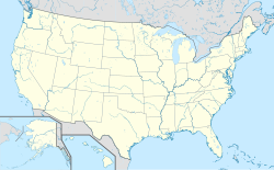
The Woodbine Municipal Airport (ICAO: KOBI , FAA LID: OBI, formerly 1N4) is a public airport, the km southeast of the central business district of themselves 4 Woodbine in Cape May County , New Jersey , USA , is located. The airport is owned by the Woodbine Port Authority .
The Med-Trans Corp rescue helicopter has been stationed at the airport since 2005 .
