French King Bridge
Coordinates: 42 ° 35 ′ 25 " N , 72 ° 29 ′ 48" W.
| French King Bridge | ||
|---|---|---|
| use | Expressway bridge | |
| Convicted |
|
|
| Crossing of | Connecticut River | |
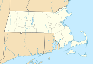
| place | Gill and Erving , Massachusetts , United States | |
| Entertained by | Massachusetts Department of Transportation | |
| construction | Arch bridge (steel) | |
| overall length | 238.4 m | |
| width | 14.57 m | |
| height | 43 m | |
| start of building | 1931 | |
| completion | 1932 | |
| opening | September 10, 1932, new building in 1992 | |
| location | ||
|
|
||
The French King Bridge is a steel bridge in the US state of Massachusetts that crosses the Connecticut River .
geography
The French King Bridge is on Massachusetts Route 2 , which largely coincides with the Mohawk Trail , between the parishes of Erving and Gill .
It is a three-arch bridge made of steel construction with spans 49.1 m - 140.2 m - 49.1 m. Construction began in September 1931 and opened on September 10, 1932 after spending approximately $ 385,000. An extensive reconstruction took place in 1992, restorations were carried out in 2008 and 2010.
The name of the bridge is derived from the nearby French King Rock , so named by a French officer during the French-Indian wars. In 1932 the American Institute of Steel Construction awarded the bridge the attribute "the most beautiful steel bridge".
swell
- French King Bridge on de.structurae.de
- French King Bridge at www.mhd.state.ma.us (Massachusetts Department of Transportation - Highway Division)


