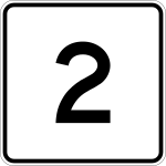
Massachusetts Route 2

|
|
|---|---|
| map | |

|
|
| Basic data | |
| Overall length: | 142.29 mi (229 km ) |
| Opening: | 1927 |
| Counties: |
Berkshire County Franklin County Worcester County Middlesex County Norfolk County Suffolk County |
The Massachusetts Route 2 is running in east-west direction State Route in the State of Massachusetts of the United States .
geography
Massachusetts Route 2 runs from North Adams in the west to Boston almost the entire area of the state in an east-west direction.
Route 2 is largely identical to the Mohawk Trail , a former path of the Mohawk Indians.
See also
Web links
Commons : Massachusetts Route 2 - Collection of Pictures, Videos, and Audio Files
- MA 2 on www.massachusettsroute2.com ( Memento from May 17, 2014 in the Internet Archive )