John F. Fitzgerald Expressway
| John F. Fitzgerald Expressway Central Artery
|
|
|---|---|
| Street in Boston | |
| Basic data | |
| place | Boston |
| Created | 1950s |
| Newly designed | 1990s to 2000s |
| Connecting roads |
Massachusetts Avenue , I-93 , US 1 , Route 3 |
| use | |
| User groups | Motor transport , public transport |
| Technical specifications | |
| Street length | 3.18 mi (5.1 km ) |
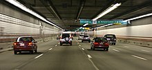
The John F. Fitzgerald Expressway (also Central Artery ) is a section of a freeway in downtown Boston in the state of Massachusetts in the United States . It was named after John F. Fitzgerald and is also designated as Interstate 93 , US Highway 1 and Massachusetts Route 3 . The expressway was originally built in the 1950s as a partially elevated route, partially guided through tunnels , but today it runs almost exclusively through tunnels that were built as part of the Big Dig and that buried the Central Artery, which used to run above ground.
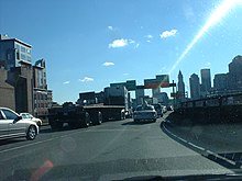
Before the renovation, the former, above-ground route was known as the “Path of Sorrows”, “the world's largest parking lot” or - mainly due to its green support girders - as “the second green monster”. After the surface road was demolished, it was replaced by the Rose Kennedy Greenway .
The expressway runs from the connection to Massachusetts Avenue on Andrew Square in the borough of South Boston from south to north to the junction of US Highway 1 in the borough of Charlestown . Together with the tunnels under Boston Harbor and the section of the Massachusetts Turnpike from Massachusetts Route 128 to East Boston , the John F. Fitzgerald Expressway is part of the Metropolitan Highway System.
history
The highway itself was planned back in the 1920s. The above-ground Central Artery was built in two sections. From 1951 to 1954, the section north of High Street to Tobin Bridge was built. Immediately after completion, the residents began to develop a pronounced aversion to the street, as it separated the parts of the city from one another and was visually unsightly. Due to this development, the second, southern section of the highway was led underground through the Dewey Square Tunnel . In the course of the Big Dig , the northern section was then relocated to the newly constructed Thomas P. O'Neill Jr. Tunnel and the road above ground was demolished. The Dewey Square Tunnel is the only section of the original Central Artery that has not been demolished.
The volume of traffic on the highway increased continuously over the years, which can be attributed, among other things, to the fact that other highway projects that were supposed to complement and relieve the Central Artery were never realized. Above all, this includes the fully planned but never built Interstate 695 . Although some renovation work was carried out on the northern section of the road before Big Dig, the problems could never be solved satisfactorily.
Exits
On the Central Artery, the exits were not numbered when the route opened. It was not until 1974 that numbering was introduced as part of its designation as Interstate 93 . Due to the multiple renovations that have taken place over the years, there are some special features today.
Exits 19, 21 and 25 have been completely removed. Exits 20 and 26 have been divided into north and south driving directions: today's exit 20 in north driving direction is at the location of old exit 19, in south driving direction it starts at the exit of the Dewey Square Tunnel . Exit 26 in the northern direction of travel begins shortly after the tunnel exit onto the Leonard P. Zakim Bunker Hill Memorial Bridge , while in the southern direction of travel in the Charlestown district it is between exits 28 and 27 and leads to the Leverett Circle Connector Bridge .
Exit 22 existed as an entrance to Chinatown until 2004, but was then closed when the Big Dig was finished. Exit 23 leads to Scollay Square , both north and south, while Exit 24 leads to Haymarket Square and the Callahan Tunnel .
Classification

The Central Artery is now designated as Interstate 93 and US Highway 1 along its entire length . The Massachusetts Route 3 but also runs on the Central Artery, it leaves in a northerly direction at Exit 26th
The John F. Fitzgerald Expressway has had a number of different road classifications throughout its history. After its construction, the section between Sumner Tunnel and Storrow Drive was designated as Massachusetts Route C1 and Massachusetts Route C9 , with the "C" standing for the "city routes" of US Highway 1 and Massachusetts Route 9, which were used by the smaller city streets had been removed. The rest of the highway remained unclassified, but was accompanied south of the Sumner Tunnel parallel by the Massachusetts Route C37 .
By 1969, the entire Central Artery was designated as Interstate 95 as it was intended to run through the city center. In 1971 the C routes were removed and the old route C1 to the new route of the US Highway 1. In the same year, Route 3 was also placed on the route of the Artery south of Storrow Drive.
In 1974 it was decided that I-95 would not run through the city center, but around the city, using part of the existing Massachusetts Route 128 . US Highway 1 was routed so that it could use the Tobin Bridge and the Northeast Expressway , which was previously designated as part of I-95. US 1 consequently used the artery north of Storrow Drive, while its former section south of Storrow Drive to the Sumner Tunnel was designated as an extension of Massachusetts Route 1A . I-93 was led south from Charlestown on the Central Artery, the Southeast Expressway and Route 128 to Canton . In 1989, the US 1 was placed on its current course along the entire length of the artery and route 1A was shortened to the Sumner tunnel.
In the course of the Big Dig, new signs were installed, but they only identify the I-93 in order to avoid irritation.
Individual evidence
- ^ Executive Office of Transportation - Office of Transportation Planning Roads - June 2008
- ↑ Associated Press : Boston's 'Big Dig' opens to public. Tunnel project is five years behind schedule, billions over budget. MSNBC , December 20, 2003, accessed January 8, 2013 .
- ↑ Executive Office of Transportation: Office of Transportation Planning - 2007 Road Inventory ( Memento of the original of September 27, 2006 in the Internet Archive ) Info: The archive link has been inserted automatically and has not yet been checked. Please check the original and archive link according to the instructions and then remove this notice.
- ↑ John F. Fitzgerald Expressway (Central Artery). bostonroads.com, accessed January 8, 2013 .
Remarks
- ↑ The term green monster is a popular nickname among baseball fans for the 37 ft (11.3 m ) high green wall in Fenway Park Stadium of the Boston Red Sox .
Web links
Coordinates: 42 ° 21 '15.2 " N , 71 ° 3' 9.7" W.


