Soldiers Field Road
| Soldiers Field Road | |
|---|---|
| Street in Boston | |
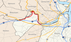
| The course of the road is marked in red. | |
| Basic data | |
| place | Boston |
| Connecting roads |
Storrow Drive (East) |
| Technical specifications | |
| Street length | 4.3 mi (6.9 km ) |

The Soldiers Field Road eastbound in Allston
The Soldiers Field Road is a very busy traffic Parkway in Boston in the state of Massachusetts of the United States . The road begins in the west on US Highway 20 in the Brighton district and first leads to Boston University Bridge . It then follows the course of the Charles River and leads past Harvard University and Boston University . The Soldiers Field Road is part of a nearly 9 mi (14,5 km long), continuous street of houses along the south bank of the Charles River, the east in the form of Storrow Drive , the David G. Mugar Way and Embankment Road and in continues westward as Nonantum Road .
Individual evidence
- ^ Office of Geographic Information (MassGIS). Retrieved September 28, 2012 .
Coordinates: 42 ° 22 ′ 22 " N , 71 ° 7 ′ 45" W.
