
Massachusetts Route 128

|
|
|---|---|
| map | |

|
|
| Basic data | |
| Overall length: | 57.58 mi (92.7 km ) |
| Opening: | 1927 |
| Starting point: |
|
| End point: |
|
| Counties: |
Norfolk County Middlesex County Essex County |
| Important cities: | Boston , Cambridge |
The Massachusetts Route 128 (also known as Yankee Division Highway , originally Circumferential Highway is) a 57.58 mi (92.7 km ) long state highway in the state of Massachusetts of the United States with gradient from south to north. It is designed as a ring road around Boston and about 60% part of the national interstate highway system. With the increasing growth of cutting-edge technology in the suburbs along the route from the 1960s to the 1980s, Route 128 itself became a symbol of high-tech society. Today, however, companies in this branch of industry have increasingly settled along the neighboring Interstate 495 ring road .
Local residents view Route 128 as a dividing line between the inner communities of the Greater Boston metropolitan area and the suburbs further out. The approximately 10 mi (16.1 km ) radius of the ring road also roughly covers the area that can be reached within the framework of public transport with the MBTA . Much of the area within Route 128 was developed before the Second World War , while the properties further outside were only developed more recently.
Via route 128
Routing
Today's route begins south in Canton at the junction with Interstate 95 , which continues south towards Providence , Rhode Island . Until 1997, however, Route 128 was identical to Interstate 93 further southeast to Braintree , from where I-93 together with Massachusetts Route 3 leads north towards downtown Boston. This former section of Route 128 also represents the northern end of Massachusetts Route 24. Until 1965, Route 128 led beyond this point to be identical to Route 3 and Route 228 to Hull .
From Canton, Route 128 runs identical to I-95 in a clockwise arc around Boston to Peabody , where I-95 separates north to Portsmouth , New Hampshire . Along this section, Route 128 has interchanges with Interstate 90 , Massachusetts Route 2 , US Highway 3, and Interstate 93 . However, the access roads usually only point to the I-95 . Since 1989 runs on a short section of the south at Dedham also the US Highway 1 identical to Route 128 .
After Route 128 has separated from I-95 in Peabody , it continues eastward to Cape Ann , where it ends at a junction with connection to Massachusetts Route 127 and Massachusetts Route 127A in Gloucester .
Although the route is largely identical to either I-93 or I-95 , most residents refer to the entire route as Route 128 , including the formally no longer existing continuation south of Canton and other parts of I-95 that are not recognizable as Route 128 . This dates back to before the introduction of the interstate highways and became part of the local culture.
Background information

The designation of the route as Route 128 goes back to the origins of the US highway system in the 1920s. In the 1950s the route ran from Nantasket Beach in Hull to Gloucester . The first, 27 mi (43.5 km ) long section from Braintree to Gloucester was opened in 1951, making it the first ring road - taking into account its property as a motorway with the associated restrictions on vehicles that must reach a certain minimum speed - in the United States.
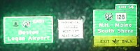
Until 1965, when Massachusetts Route 3 to Cape Cod was completed, the section of today's Route 3 between exits 15 and 20 was also designated as Route 128 . The southern end of the route was shortened this year to the connection to Route 3 in Braintree and the section through Hingham to Nantasket Beach was re-designated as Massachusetts Route 228 . The Massachusetts Highway Department tried several times to shorten Route 128 to the intersection with I-95 in Peabody , but always failed due to resistance from local residents. Traces of these attempts can be seen at every intersection of Route 128 , where the large main signs indicate the route as I-95 and only small signs on the side of the road indicate Route 128 .

Many companies in the high-tech sector have settled along the western part of Route 128 , which is why this part of the route is also known as the “America's Technology Highway”.
The routing of Route 128 describes an arc of more than 180 degrees around Boston , and driving clockwise on the road is referred to as "northbound" even if you are actually going slightly south when arriving at the Atlantic . Local residents describe this as "driving in the direction of the logical north" and driving counterclockwise consequently as "driving in the direction of the logical south".
The simultaneous designation of part of the route as US Highway 3 is due to the fact that it ends in Burlington at an intersection with Route 128 and not - as planned in the planning - further south on Massachusetts Route 2 in Lexington . This abrupt end required the parallel designation of a small part of Route 128 as US Highway 3 until it rejoins its old route. Before Route 128 was shortened to Canton, the course of Route 128 and the identical I-93 were shown reversed, ie you could drive on the same road as Route 128 to the south and as I-93 to the north.

The northernmost exits of Route 128 after exit 12 are designed as level crossings , which are implemented with both traffic lights and roundabouts . In the 1990s, the sequentially numbered exits of Route 128 were re-numbered with reference to the I-95 system, replacing the original numbering from Gloucester to Braintree with a new one that ran from the Rhode Island state line to the New state line Hampshire is enough. Only exit 37 kept its number, as it leads to exit and access No. 37 of the I-93 . As a result, some of the exits are numbered inconsistently and logically difficult to understand.
The high-tech region along the way
Many high-tech companies have set up shop along Route 128 , including Digital Equipment Corporation , Data General , Thermo Fisher Scientific , Analog Devices , Computervision , Polaroid , Sun Microsystems , BEA Systems and Raytheon . At the turn of the millennium in particular, however, the region had to contend with high vacancies of up to 27% of office space and up to 44% of space for research and development activities.
history
Southern Circumferential Highway
The Route 128 was first defined in 1927 and led from the junction of Massachusetts Route 138 in Milton to the west around Boston until after the Massachusetts Route 107 in Salem and ran it along the following route:
| place | Streets |
|---|---|
| Milton | Milton Street |
| Boston ( Hyde Park ) | Neponset Valley Parkway , Milton Street |
| Dedham | Milton Street, High Street, Common Street, West Street |
| Needham | Dedham Avenue, Highland Avenue |
| Newton | Needham Street, Winchester Street, Center Street, Walnut Street, Crafts Street, Waltham Street |
| Waltham | High Street, Newton Street, Main Street ( US Highway 20 ), Lexington Street |
| Lexington | Waltham Street, Massachusetts Avenue ( Route 2A , now Route 4 / Route 225 ), Woburn Street |
| Woburn | Lexington Street, Pleasant Street, Montvale Avenue |
| Stoneham | Montvale Avenue, Main Street ( Route 28 ), Elm Street |
| Wakefield | Albion Street, North Avenue, Water Street, Vernon Street, New Salem Street, Salem Street |
| Lynnfield | Salem Street |
| Peabody | Lynnfield Street, Washington Street, Main Street |
| Salem | Boston Street |
In 1928, Route 128 was extended eastward from its southern end to Quincy , where it ended at the junction with Route 3 or Route 3A (now Route 3A and Route 53 ). The new section ran along the following route:
| place | Streets |
|---|---|
| Quincy | Washington Street, Hancock Street, Adams Street |
| Milton | Adams Street, Center Street, Canton Avenue, Dollar Lane |
Central Circumferential Highway
The first section of the Circumferential Highway , which in no way corresponded to today's highway, consisted of the section from Route 9 in Wellesley along the Boston south side to what was then Route 3 (now Route 53 ) in Hingham . Part of this route had to be rebuilt, but most of it was led along existing streets that were expanded to cope with the greater traffic load.
In 1931, the Massachusetts Department of Public Works acquired the rights to part of Route 138 from Canton via Westwood , Dedham and Needham to Route 9 in Wellesley. As early as 1927, Norfolk County had acquired the rights to a stretch from Route 138 in Canton east through the Blue Hills Reservation via Milton and Quincy to Braintree to build the Blue Hill River Road following West Street in northwestern Braintree which in turn led to Route 37 in the center of Braintree. The remaining part of the new highway from Route 37 eastwards to today's Route 53 through Braintree, Weymouth and Hingham had been in the state since 1929.
In 1933, the Circumferential Highway was completed and, with the exception of a section from Route 9 in Wellesley to Highland Avenue in Needham, designated Massachusetts Route 128 . The entire stretch of the highway thus included the following roads:
| place | Streets |
|---|---|
| Hingham | Derby Street, Old Derby Street |
| Weymouth | Ralph Talbot Street, Park Avenue, Columbian Street |
| Braintree | Columbian Street, Grove Street, Washington Street ( Route 37 ), Franklin Street (Route 37), West Street, a street in the Blue Hills Reservations |
| Quincy | a street in the Blue Hills Reservations, Blue Hill River Road |
| Milton | Blue Hill River Road, Hillside Street |
| Canton | Blue Hill River Road, Royall Street, Green Lodge Street to the intersection with Interstate 95 |
| Westwood | Blue Hill Drive to Route 128 Station on the MBTA |
| Needham | Greendale Avenue, Hunting Road, Route 128 under Highland Avenue, Reservoir Street |
| Wellesley | Today's junction with Route 9 |
Simultaneously with the designation of Route 128 on the new Circumferential Highway , it was also extended to Hull . This additional section led in a south-easterly direction on today's Route 53 to the border to Hingham and Norwell , where the route turned north on today's Route 228 in the direction of Hull . The designated route ended at the southern end of Nantasket Beach .
Signage
Current state
- Change in signage over time

Before the course of the I-95 was placed on Route 128 in the 1970s , this was clearly signposted.

After the relocation of I-95 on the route of Route 128 , the new street signs referred only to the I-95 down, while Route 128 was awarded only on small signs on the roadside.
Only the signs on the Massachusetts Turnpike also point to Route 128 today .


Signage improvement projects
The successive replacement of the street signs, some of which were up to 25 years old, began in 1998. As a first step, all signs between Reading and Lynnfield were replaced by 2002 as part of a US $ 1.1 million project . In 2005 and 2006 the signs from Peabody to Gloucester followed , which cost a total of 2.2 million US dollars, and in 2008 and 2009, respectively, another 1.4 million dollar signs were exchanged in Peabody and the remaining signs in Lynnfield . In 2010 and 2011, federal funding of $ 2.9 million was used to replace all signs on Route 128 from the junction with US Highway 3 in Lexington to the intersection with I-93 in Reading .
For the end of 2012 another project with a budget of 4.5 million dollars is planned that all signs on Route 128 , beginning at the connection to the Massachusetts Route 9 in Wellesley before exiting onto the Route 4 / Route 225 in Lexington to renew . This was mostly described as a waste of money by the local press; after all, as long as you are stuck in a traffic jam, you can stare at beautiful new street signs.
However, the completion of the work is only planned for a project scheduled for 2014, in which street signs from Highland Avenue in Needham to Massachusetts Route 109 in Dedham will be replaced. The signs between I-95 and US 1 were replaced in 2010 and most of the signs between I-95 and Massachusetts Route 24 were replaced in December 2011.
List of exits
Due to the eventful history of the route, the numbering of the exits is inconsistent and sometimes difficult to understand. The following information corresponds to the route in 2012.
| county | place | exit | Connection connections | Remarks |
|---|---|---|---|---|
| South end of Route 128 | ||||
| Norfolk | Canton | 1 |
|
I-95 continues south to Providence ( Rhode Island ), I-93 and US 1 continue east on the same route to Braintree . |
| Dedham | 13 | University Avenue | ||
| Westwood | 14th | East Street , Canton Street | ||
| Dedham | 15th |
|
Designated as exits 15A and 15B | |
| 16 |
|
Designated as exits 16A and 16B | ||
| 17th |
|
|||
| Needham | 18th | Great Plain Avenue - Dedham , West Roxbury | ||
| 19th | Highland Avenue - Newton Highlands | Designated as exits 19A and 19B | ||
| Wellesley | 20th |
|
Designated as exits 20A and 20B | |
| Middlesex | Newton | 21st |
|
Designated as exits 21 (north direction) and 21A (south direction) |
| 22nd | Grove Street - Auburndale | |||
| Weston | 23 | Recreation Road | Only exit in a northerly direction | |
| 25th |
|
In the northerly direction of travel, exit 25 is before exit 24 | ||
| 24 |
|
|||
| Waltham | 26th |
|
||
| 27 | Totten Pond Road / Wyman Street / Winter Street - Waltham | Designated as exits 27A and 27B | ||
| 28 | Trapelo Road - Belmont , Lincoln | Signed as exits 28A and 28B to the north | ||
| Lexington | 29 |
|
Designated as exits 29A and 29B | |
| 30th |
|
Designated as exits 30A and 30B | ||
| 31 |
|
Designated as exits 31A and 31B | ||
| Burlington | 32A |
|
The US 3 joins Route 128 in the north and leaves it in the south | |
| 32B | Middlesex Turnpike - Arlington | |||
| 33 |
|
Designated as exits 33A and 33B; US 3 joins Route 128 in a southerly direction and leaves it in a northerly direction |
||
| 34 | Winn Street - Woburn , Billerica | |||
| Woburn | 35 |
|
||
| 36 | Washington Street - Winchester | |||
| Reading | 37 |
|
Designated as exits 37A and 37B | |
| 38 |
|
Designated as exits 38A and 38B | ||
| Wakefield | 39 | North Avenue - Reading | ||
| 40 |
|
|||
| Essex | Lynnfield | 41 | Main Street - Lynnfield , Wakefield | |
| Middlesex | Wakefield | 42 | Salem Street | |
| Essex | Lynnfield | 43 | Walnut Street - Saugus , Lynn | |
| Peabody | 44 |
|
Signed as exits 44A and 44B to the north | |
| 45/ 29 |
|
Exit 29 only exists in the southern direction of travel; in the northern direction it is designated as no. 45; End of the identical course of Route 128 with I-95 |
||
| 28 | Forest Street / Centennial Drive | |||
| 26th | Lowell Street - Salem | The former exit 27 no longer exists | ||
| 25th |
|
Designated as exits 25A and 25B | ||
| Danvers | 24 | Endicott Street | ||
| 23 |
|
|||
| 22nd |
|
|||
| 21st | Conant Street / Trask Lane / Wayside Drive | |||
| Beverly | 20th |
|
Designated as exits 20A and 20B | |
| 19th | Sohier Road / Brimbal Avenue | |||
| 18th |
|
|||
| Wenham | 17th | Grapevine Road - Beverly Farms , Prides Crossing | ||
| Manchester | 16 | Pine Street - Magnolia | ||
| 15th | School Street - Magnolia | |||
| Gloucester | 14th |
|
||
| 13 | Concord Street - Wingaersheek Beach | |||
| 12 | Rust Island Road / Biskie Head Point / Causeway Street | |||
|
|
Grant Circle Roundabout ; in the logically northerly direction of travel, the exits are no longer numbered from here. |
|||
| School House Road / Dory Road | Blackburn Circle roundabout | |||
|
|
street intersection at the same level | |||
|
|
T-junction at the same level | |||
| North end of Route 128 | ||||
In pop culture
In both alternative rock rhythm songs Roadrunner by The Modern Lovers and Blue Thunder of Galaxie 500 that comes Route 128 before.
See also
Individual evidence
- ^ Road Inventory. (No longer available online.) Massachusetts Department of Transportation, archived from the original on June 20, 2012 ; accessed on November 2, 2012 . Info: The archive link was inserted automatically and has not yet been checked. Please check the original and archive link according to the instructions and then remove this notice.
- ^ Jeff Miller: Job seekers look for answers in WIND. (No longer available online.) In: Mass High Tech =. August 19, 2002, archived from the original on August 6, 2012 ; accessed on November 2, 2012 . Info: The archive link was inserted automatically and has not yet been checked. Please check the original and archive link according to the instructions and then remove this notice.
- ↑ Susan Rose Grant, David Lampe: Route 128 . Lessons from Boston's high-tech community. Basic Books, New York 1992, ISBN 978-0-465-04639-3 .
- ↑ Susan habenhouse: COMMERCIAL REAL ESTATE; Layoffs Create Glut of Space in Boston Area. In: The New York Times . February 5, 2003, accessed November 3, 2012 .
- ↑ Joe Battenfeld: State's all signed up. DOT splurges $ 4.5M on Route 128. (No longer available online.) In: Boston Herald . May 30, 2012, formerly in the original ; accessed on November 4, 2012 (English, paid article). ( Page no longer available , search in web archives ) Info: The link was automatically marked as defective. Please check the link according to the instructions and then remove this notice.
- ↑ Taken from Google Maps .