Acton (Massachusetts)
| Acton | ||
|---|---|---|
 |
||
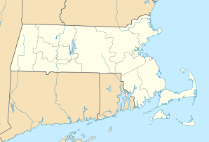
| Location in Massachusetts | ||
|
|
||
| Basic data | ||
| Foundation : | 1735 | |
| State : | United States | |
| State : | Massachusetts | |
| County : | Middlesex County | |
| Coordinates : | 42 ° 29 ′ N , 71 ° 26 ′ W | |
| Time zone : | Eastern ( UTC − 5 / −4 ) | |
| Residents : | 21,924 (as of 2010) | |
| Population density : | 424.1 inhabitants per km 2 | |
| Area : | 52.5 km 2 (approx. 20 mi 2 ) of which 51.7 km 2 (approx. 20 mi 2 ) are land |
|
| Height : | 79 m | |
| Postcodes : | 01720, 01718 | |
| Area code : | +1 351-978 | |
| FIPS : | 25-00380 | |
| GNIS ID : | 0618213 | |
| Website : | www.acton-ma.gov | |
Acton is a city in Middlesex County , Massachusetts , United States , about 34 kilometers northwest of Boston and about eighteen kilometers southwest of Lowell with a population of 21,924.
history
The area around Acton was settled 7,000 years ago, but the number of the indigenous population declined sharply after the arrival of European settlers due to introduced diseases. After the Acton area was initially used as pastureland, the first Europeans settled there in 1639. Acton was declared an independent city on July 3, 1735.
During the Revolutionary War , local militias fought against British troops on the outskirts of the city in the skirmishes of Lexington and Concord .
In 1844 the first railway line to Acton was opened, which, together with industrialization, led to an economic boom in the city.
In the 20th century, Acton experienced a strong population growth of around 2,000 by ten times to over 20,000.
sons and daughters of the town
- Henry Durant (1802–1875), theologian and university professor
- Pam Fletcher (* 1963), ski racer
- Jeff Norton (born 1965), ice hockey player

