Framingham
| Framingham | ||
|---|---|---|
 Town Hall |
||
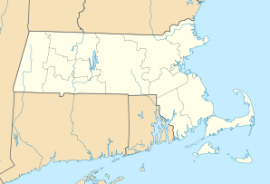
| Location in Massachusetts | ||
|
|
||
| Basic data | ||
| Foundation : | 1650 | |
| State : | United States | |
| State : | Massachusetts | |
| County : | Middlesex County | |
| Coordinates : | 42 ° 17 ′ N , 71 ° 25 ′ W | |
| Time zone : | Eastern ( UTC − 5 / −4 ) | |
| Residents : | 68,318 (as of 2010) | |
| Population density : | 1,049.4 inhabitants per km 2 | |
| Area : | 68.5 km 2 (approx. 26 mi 2 ) of which 65.1 km 2 (approx. 25 mi 2 ) are land |
|
| Height : | 50 m | |
| Postcodes : | 01701-01705 | |
| Area code : | +1 508, 774 | |
| FIPS : | 25-24925 | |
| GNIS ID : | 0618224 | |
| Website : | www.framinghamma.gov | |
Framingham is a city in Middlesex County , Massachusetts . It has an area of 68.5 km² 68,318 inhabitants (as of 2010) and is west of Boston , east of Worcester .
The city became famous for the Framingham Study of Cardiovascular Diseases. The Sudbury Valley School is also located in Framingham .
The following international companies have their headquarters in Framingham:
- BOSE , manufacturer of hi-fi systems and speakers.
- International Data Corporation , consulting and event provider for the IT and telecommunications industry.
- Staples , retail office supplies group
- The TJX Companies, Inc. , known in Europe for the off-price stores TK Maxx .
sons and daughters of the town
- Crispus Attucks (approx. 1723–1770), victim of the " Boston Massacre "
- Marshall Brown (1920–1983), jazz trombonist, music teacher, songwriter and leader of the International Youth Band
- Ginger Fish (born 1965), drummer
- Richard W. Higgins (1922–1957), United States Air Force pilot
- Paul Stephen Loverde (born 1940), Catholic clergyman, former Bishop of Arlington
- Peter Hopkins (* 1955), painter
- Jo Dee Messina (born 1970), country singer
- Peter Parker (1804–1888), doctor and missionary who long toured China during the Qing Dynasty
- George Edward Rueger (1929–2019), Auxiliary Bishop in Worcester
- Adam Schiff (* 1960), politician, member of the US House of Representatives
- Ashley Walden (* 1981), luge rider
See also
Web links
Commons : Framingham, Massachusetts - Collection of pictures, videos, and audio files

